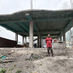
However, the panic of the past week has brought into focus the haphazard development being undertaken in this geologically unstable region. It has also served to highlight the negative consequences of unmitigated construction along the river’s embankments by the Bihar government has also come to light.
What caused the threat?
According to an inspection report by experts from the International Centre for Integrated Mountain Development in Kathmandu, a landslide rumbled down on Nepal’s Juri village, 1.4 km upstream from the Sunkoshi Hydropower project, in the north-eastern part of the country on Saturday. The rubble caused a block in the Bhote Kosi river, a tributary of the Kosi, leading to a rapid rise in the water level. This in turn caused swelling in the main river, which flows into Bihar.
Nepal’s Sunokshi Valley is vulnerable
ICIMOD experts say that since the mid-1980s, a significant number of homes, shops and five hydropower plants have come up in the region. The area’s population has been increasing rapidly due to the construction of the Araniko highway connecting India, China and Tibet.
These new constructions are being undertaken in an ill-planned manner around a geologically unstable region, these experts say. This is likely to increase the frequency of natural disasters in the area.
“This is not the first time the Sunkoshi valley has experienced a lethal flood, and it certainly won’t be the last time,” the report said. “Like many places around the Hindu Kush Himalayan region, weak geological formation and steep topography in the Sunkoshi valley, combined with frequent bouts of intense rainfall and climate change, makes it prone to different types of water-induced hazards, including landslides.”
Meanwhile, in Bihar…
Embankments along the Kosi in India were first constructed in the 19th century for irrigation but were removed because the authorities soon realised that the river was unstable, frequently changing course. As a result of the Kosi's propensity to flood, it is sometimes called Bihar's River of Sorrow. In 1952, however, the authorities began constructing embankments again.
In 1952, the embankments were 160 km long, but today, that figure has grown to 3,700 km, said Dinesh Mishra, the convenor of Barh Mukti Abhiyan, an NGO that works on flood control. While the embankments are built to control water levels during floods, the authorities also needed to put in place a mechanism to disperse the stored water and silt that come with it. This has not been done. As a result, the flood-prone area in the region, which was 25 lakh hectares in 1952, has increased to 69 lakh hectares.
Despite this, the authorities continue to increase the length of these embankments. “Tenders are released time and time again due to corruption,” Mishra said.
According to official estimates, three lakh people live inside the embankment, in nearly 380 villages. There are also about 12 lakh living on the outside, close to the river. However, experts say that the authorities do not have a concrete plan to evacuate all of them if the danger re-emerges.
After the waters rose on August 2, the Disaster Management Department evacuated over 70,000 people residing in nine districts. However, 2.5 lakh people were still awaiting rescue before the threat receded. The event has yet again exposed the Bihar state government's inability to come up with a comprehensive disaster management plan.
For now, there seems to be no relief in sight for those living along the Kosi embankments. “Northern Bihar has always been a flood-prone area because of the unstable nature of the Kosi river,” said Mishra. “Nearly 73% of the population [of the region] continues to live under the recurring threat of flood devastation. Every year, assets like livestock, worth millions, are destroyed.”


