


“Can you believe that our airport roof got blown away?” asked Rani Sarma, an environmental activist living in Visakhapatnam, the worst hit city in Cyclone Hudhud. The cyclone, with winds reaching more than 200 kilometers per hour, uprooted 70% of the city’s trees and caused thousands of crores worth of damage in public and private property.
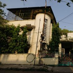
In the aftermath, Sarma saw that communication towers had been toppled, power lines cut, roads blocked and shop frontages shattered or disappeared altogether. “This kind of architecture in the city has to change," she said. "Architecture has to be sea-coast friendly.”
A report from The Energy and Resources Institute released days before Cyclone Hudhud hit the east coast listed Visakhapatnam’s vulnerabilities to storms and rising sea levels. TERI estimates that the sea level at Visakhapatnam is rising at an average rate of 1.09 millimetres per year. The institute predicts that sea level rise coupled with extreme weather events like cyclones and excessive rainfall will lead to greater ad more frequent flooding in the city.
The TERI report points out that the airport is one of the most vulnerable areas in the city, and indeed, it was one of the most severely affected structures during Cyclone Hudhud. The airport is located at the lowest lying area in Visakhapatnam. This isn't the first time the airport has flooded. It was shut down in 2005 following heavy rain, after which the city built man-made barriers and created some drainage system.
“This time it not only got flooded but also damaged because of high speed winds,” said Divya Sharma, the lead author of the report. “We are using glass all over the airport. Even if it is high-performance glass and takes the load of the wind, you can’t be sure about other hoardings and things that the wind is bringing with it and damaging the structure, which has had a lot of investment put into it.”
No regard for coastal zone regulations
The list of Visakhapatnam’s vulnerabilities is long – the port area that is also the industrial hub is prone to storm surge and flooding. Low elevation and high development areas like the railway station and beach road are also open to inundation. The beach road in particular is a hotspot for coastal regulation zone violations. “A lot of construction, particularly residential, has come up along RK Beach," Sharma observed. "There is the beach, there is a road and then there are houses. You can see it clearly. Zonation has been done but the implementation and monitoring is almost negligible.”
Said Visakhapatnam-resident Sarma, “Anyone who says ‘follow coastal zone regulation’ is looked at as an enemy of development. Mangroves have been destroyed and wetlands have been given away as badlands for industrial purposes.”
CRZ violations are rampant across all coastal cities in India, and in Mumbai it is the biggest failing and the single biggest cause for pushing the city to the brink of environment disaster, says Stalin D, director of projects at the environmental NGO Vanashakti. Spaces that were mandated to be left open under CRZ norms have been encroached upon or granted exemptions. On the other hand, Mumbai has been continuously losing its beaches to erosion and more than half the city’s beaches are under water now. “All it takes is one cyclone to hit us and we will know the importance of CRZ,” Stalin said. "This notification meant to protect the coast has been abused so badly and violated so often that it has become a joke."
Panaji also faces the threat of severe and recurring flooding and, like Visakahpatnam, TERI has charted out its vulnerablities. The destruction of mangroves on khazan lands (saline floodplains), sewage and garbage in water creeks, destruction of sand dunes, obstruction of the natural drainage by construction and the pressure of the floating tourist population makes the city’s infrastructure even more vulnerable, according to the TERI report.
Map, monitor then plan
The first step to making coastal cities climate-resistant, Sharma says, is to identify how to protect critical infrastructure like hospitals, schools, energy and telecom lines, transport facilities, sewerage and drainage, and industry.
The next is to create satellite maps to monitor changes in the landscape. “There is no benchmark for monitoring data, particularly spatial data,” Sharma said. TERI is building a database using geographical information systems to superimpose various maps see how the area is changing.
Sharma hopes that the Visakhapatnam city planners will use the database and is optimistic that Cyclone Hudhud has been the much-needed wake up call to strengthen the city against extreme weather. “Phailin happened, Helen happened we did not see much," she said. "After Hudhud suddenly I can see a lot of hue and cry because the city has been affected and the nature of damage can be estimated in crores of rupees.”
We welcome your comments at
letters@scroll.in.
In the aftermath, Sarma saw that communication towers had been toppled, power lines cut, roads blocked and shop frontages shattered or disappeared altogether. “This kind of architecture in the city has to change," she said. "Architecture has to be sea-coast friendly.”
A report from The Energy and Resources Institute released days before Cyclone Hudhud hit the east coast listed Visakhapatnam’s vulnerabilities to storms and rising sea levels. TERI estimates that the sea level at Visakhapatnam is rising at an average rate of 1.09 millimetres per year. The institute predicts that sea level rise coupled with extreme weather events like cyclones and excessive rainfall will lead to greater ad more frequent flooding in the city.
The TERI report points out that the airport is one of the most vulnerable areas in the city, and indeed, it was one of the most severely affected structures during Cyclone Hudhud. The airport is located at the lowest lying area in Visakhapatnam. This isn't the first time the airport has flooded. It was shut down in 2005 following heavy rain, after which the city built man-made barriers and created some drainage system.
“This time it not only got flooded but also damaged because of high speed winds,” said Divya Sharma, the lead author of the report. “We are using glass all over the airport. Even if it is high-performance glass and takes the load of the wind, you can’t be sure about other hoardings and things that the wind is bringing with it and damaging the structure, which has had a lot of investment put into it.”
No regard for coastal zone regulations
The list of Visakhapatnam’s vulnerabilities is long – the port area that is also the industrial hub is prone to storm surge and flooding. Low elevation and high development areas like the railway station and beach road are also open to inundation. The beach road in particular is a hotspot for coastal regulation zone violations. “A lot of construction, particularly residential, has come up along RK Beach," Sharma observed. "There is the beach, there is a road and then there are houses. You can see it clearly. Zonation has been done but the implementation and monitoring is almost negligible.”
Said Visakhapatnam-resident Sarma, “Anyone who says ‘follow coastal zone regulation’ is looked at as an enemy of development. Mangroves have been destroyed and wetlands have been given away as badlands for industrial purposes.”
CRZ violations are rampant across all coastal cities in India, and in Mumbai it is the biggest failing and the single biggest cause for pushing the city to the brink of environment disaster, says Stalin D, director of projects at the environmental NGO Vanashakti. Spaces that were mandated to be left open under CRZ norms have been encroached upon or granted exemptions. On the other hand, Mumbai has been continuously losing its beaches to erosion and more than half the city’s beaches are under water now. “All it takes is one cyclone to hit us and we will know the importance of CRZ,” Stalin said. "This notification meant to protect the coast has been abused so badly and violated so often that it has become a joke."
Panaji also faces the threat of severe and recurring flooding and, like Visakahpatnam, TERI has charted out its vulnerablities. The destruction of mangroves on khazan lands (saline floodplains), sewage and garbage in water creeks, destruction of sand dunes, obstruction of the natural drainage by construction and the pressure of the floating tourist population makes the city’s infrastructure even more vulnerable, according to the TERI report.
Map, monitor then plan
The first step to making coastal cities climate-resistant, Sharma says, is to identify how to protect critical infrastructure like hospitals, schools, energy and telecom lines, transport facilities, sewerage and drainage, and industry.
The next is to create satellite maps to monitor changes in the landscape. “There is no benchmark for monitoring data, particularly spatial data,” Sharma said. TERI is building a database using geographical information systems to superimpose various maps see how the area is changing.
Sharma hopes that the Visakhapatnam city planners will use the database and is optimistic that Cyclone Hudhud has been the much-needed wake up call to strengthen the city against extreme weather. “Phailin happened, Helen happened we did not see much," she said. "After Hudhud suddenly I can see a lot of hue and cry because the city has been affected and the nature of damage can be estimated in crores of rupees.”