


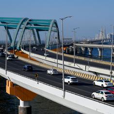


Residents of Sidco Nagar in Chennai are still reeling from the effects of the flood last year, when the neighbourhood half-disappeared under several feet of water.
Sidco Nagar was one of the worst-affected areas during the floods in the city caused by torrential rains in November and December.
The residential area and the adjoining Sidco Industrial Estate were built on the erstwhile Konnur Lake. As is the case with any natural reservoir, the lake was in a low-lying area, which acts as a collection point for water from surrounding neighbourhoods.
“But the housing board selected this [lake area] for the housing purposes,” said PA Chittibabu, general secretary of Sidco Nagar for 30 years now. “We have constructed over 4,000 houses, so now there is no water body here. But during the floods, we suffered for up to 20 days.”
However, with less than three months to go before the receding North East monsoon, when Chennai gets the bulk of its rainfall, the city is in no way better prepared to tackle heavy rains.
Who cares about water bodies?
The water body that Sidco Nagar and other development projects swallowed up was spread across 250 acres, according to a social audit report released in early August by Arappor Iyakkam, an NGO in Chennai. One glance of the 1972 Survey of India map is enough to validate that.

Today, the lake covers just 20 acres. But the Chennai’s urban planning authority does not even recognise that much in its master plan of the city’s development – instead, it has termed the entire area as an institutional plot, paving the way for further development on whatever is left of the lake. A metro project, for instance, came up here in 2013.

The Chennai Metropolitan Development Authority’s plan, prepared in 2008, is a blueprint for the city’s development till 2026. It chalks out the land use for the entire city – which areas can be used for industrial development, as institutions, residential complexes, agriculture, water bodies and so on. Accordingly, licences for construction are provided by the government authorities.
In the map below, the horizontal red lines indicate institutional land in the city, which includes the area occupied by Konnur Lake.

The Konnur Lake is not the only water body that has gone unnoticed by the urban planning body. The Ennore Creek, a swamp-like backwater in North Chennai with the tidal mudflats, marshes and fishing villages, now also houses large petrochemical industries that are unrestrained in dumping toxic fly ash and chemical-ridden water in and around the river.
By deeming the Ennore Creek a zone for hazardous industries and the Konnur Lake for institutional development – both places were deluged during the December floods – the urban planning authorities have clearly not taken existing hydrology and ecological sensitivity of the areas into question while planning the city’s growth.
In fact, nearly 90% of the area reserved for Special and Hazardous Industries by the Chennai Metropolitan Development Authority in Ennore Creek reportedly constitutes salt pans, fish farms and tidal water bodies that fall under Coastal Regulation Zones. These wetlands are crucial as they are natural sponges that prevent flooding by soaking up surface water, rain water and floodwaters, apart from hosting a diverse ecosystem.
Mind the gaps
In June 2016, the Citizen Consumer and Civic Action Group of Chennai filed an RTI plea asking the urban planning authorities if the master plan had taken into account the complete list of water bodies in the city.
The Chennai Metropolitan Development Authority responded saying: “The water bodies indicated…is not the complete ones in the Chennai metropolitan Area. As the Master Plan is a Broad Brush zoning map, small narrow water bodies may fall into land uses of agriculture, industrial, institutional etc.”
The urban planning body said that they do not have a list of all water bodies in Chennai.
The master plan is based on maps belonging to the revenue department. The tehsildar, or the local administrator, however, has a different set of maps, which include more minute details of the topography in that particular area.
In its response to the RTI plea, the Chennai Metropolitan Development Authority admitted that it does not have the kind of details on its map that the tehsildar does, but says that “such accuracy is not required in the master plan. There is no plan to incorporate and integrate the information.”
Activist Nityanand Jayaraman said that a master plan, by definition, must bring together various data sets and sources to come up with detailed development plans. If this has not been done, he said, it is worthless and can do more damage than good.
“By stating that the master plan authors did not have access to data about water bodies, the RTI shows that the master plan has not been designed with hydrology as a concern,” Jayaraman said. “Chennai's master plan appears to be a sham, and a blueprint for filling the pockets of corrupt administrations and revenue officials along the chain.”
Ideally, the master plan should be drafted after carefully examining the existing use of each part of the city, before opening it up for industrial or development activity.
So how did Konnur Lake lose its status as a water body?
Powerful tehsildars
For reclassifying land or water bodies – changing their land use in the master plan – the approval of the tehsildar is required, except when there is a direct order from the government.
After the floods, the Chennai Municipal Development Authority introduced the rule that a builder must provide a certificate from the tehsildar stating that construction is not being carried out on a water body.
In the RTI reply, the urban planning authority said that information provided by the tehsildar is not verified, because with incomplete maps, they do not have the means to do so.
In other words, if the builder produces a certificate from the tehsildar stating that there is no water body on a site where they propose construction, the urban planning body does not cross-check the claim.
“Some of the information is with the tehsildar’s office and some with the state revenue department,” said Tara Murali, an architect. “In today’s age of digitisation, why can’t the tehsildar’s information be integrated into the master plan?”
Small Steps
Eight months after the heaviest rainfall recorded in 100 years in Chennai flooded large parts of the city, killing more than 300, damaging property worth several thousand crores and leaving thousands stranded at home without electricity, food or drinking water, the citizens of Chennai are restless. With the monsoons fast approaching, there is grave concern over the rivers filled with silt, dysfunctional canals that are meant to pump out rainwater and relentless encroachment on water bodies.
The Chennai Municipal Development Authority now requires each project to have an indication of the prevailing flood line – the highest level up to which water rises in the monsoons – and take all necessary precautions in the design of basements, said Durganand Balsavar, the principal architect of Artes-Human Settlements Development Collaborative in the city, who also works with the Master Plan Committee.
But with the urban planning authority’s unwillingness to take note of smaller waterways and channels, the prospect of another disaster this year looms large.
“We get little bit of information that something is being desilted or something else is being cleared,” said Murali, “But there is no cohesive policy and nobody has identified the various problems or which department is going to plan and execute a strategy for flood prevention. For all I know, this year if we have a similar amount of rainfall, we may again lose many lives.”