


On a warm November afternoon, as I left the traffic of Dehradun behind and drove up the hills to Mussoorie, the voice of a presenter on an FM radio station echoed what I had heard from scores of people in Uttarakhand’s capital city: “Dehradun is turning into Delhi.”
The comment caught the attention of the driver, a young man named Danish Aslam. “The city has changed a lot, and not in a good way,” he told me. “It was the capital of the hills, but now it looks just like any other town in the plains, like Moradabad or Meerut.”
Born and raised in Dehradun, Aslam said he used to participate in cycling tournaments in his childhood, which have entirely stopped now. “Where do you cycle now? There’s no space to even walk.”
The octogenarian writer Ruskin Bond, who lived in Dehradun in the 1940s before permanently settling in Mussoorie in the 1960s, rued the fact that that all his favourite childhood haunts in the city had disappeared. “Few remain, like the peepal tree near Ghanta Ghar,” he said, referring to the clocktower in the heart of the town.
These weren’t uncommon kinds of complaints to hear from city dwellers in India, but it was striking to hear it made of Dehradun.
Once a pristine colonial town dotted with canals and fruit orchards, in the last two decades, Dehradun has seen an exceptionally intense burst of growth that has left it crowded, polluted and water deficient.
“Now the canals have been cemented over, the trees have been cut,” said Anil Joshi, an environmentalist who has lived in the city since 1980s. “Is this how you develop a city, by destroying its essence?”
Longtime Dehradun residents as well as government officials say that this downslide was accelerated after 2000, when the city was declared the capital of the newly formed Uttarakhand state. This was also when the city’s development, as well as that of the 30-km-long Dehradun-Mussoorie road, and Mussoorie town itself, became the subject of a new “master plan” that was intended to ensure sustainable long-term growth.
Every major Indian city has a master plan: a blueprint of a city’s development, typically laid out for a period of two decades.
The idea of such master plans was first introduced in the Third Five Year Plan, drafted in the 1960s by the Planning Commission, the organisation within the Indian government that formulated detailed socioeconomic strategies for the country towards specific goals, until it was disbanded in 2014. The Third Five Year Plan, which spanned the years from 1961 to 1966 observed that there was “a need to undertake the preparation of master plans for urban areas” and that without such plans, “there is no means of bringing together and maximising the contribution of different agencies towards well-defined common objectives pursued systematically over a long period.” The document also noted, “The primary responsibility for the preparation of master plans lies with State Governments and the local administrations concerned.”

It was around this time, in 1957, that the Delhi Development Authority, the first agency that would be tasked with overseeing such a master plan, was formed, by an act of Parliament. The DDA became a model for other states to follow. In 1973, the Uttar Pradesh government passed the Uttar Pradesh Planning and Development Act to develop cities like Lucknow, Kanpur, Varanasi and Allahabad along the Delhi model, and set up authorities like the DDA for each of them.
In 1984, under this town planning act, Dehradun town, comprising 172 villages and Mussoorie, comprising 13 villages, were brought under the newly created Mussorie Dehradun Development Authority. A blueprint for the next two decades, the Master Plan 1981-2001, was finalised in 1985.
When this master plan lapsed in 2001, a new state had come into being – with Dehradun as its new interim capital. As pressure on the city’s land and infrastructure intensified, instead of strengthening its development plan, the authorities delayed drafting and implementing a new one.
This delay, according to many government officials, urban planners and residents, has led to a situation where Dehradun is frequently counted among India’s ten most polluted cities. Even as Dehradun’s authorities draft a new plan, tracing the evolution of the current master plan is revealing of how in India, such strategies are often poorly thought out, and even more poorly executed.
This story is part of Common Ground, our in-depth and investigative reporting project. Sign up here to get a fresh story in your inbox every Wednesday.
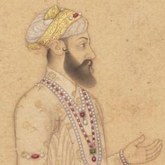
Modern Dehradun was born in the 1700s. The city gets its name from a Sikh dera, a kind of settlement, which once existed in what is now Paltan Bazar, in the heart of the city. A dargah, or shrine, which lay within the dera still exists, dedicated to Guru Ram Rai, a Sikh leader who was given the fiefdom of Dehradun by Aurangzeb. Ram Rai’s father, the seventh guru of Sikhism, excommunicated him from the religion because he appeased the Mughal ruler.
Since then, the Dehradun region, and Mussoorie in particular, has been a place of refuge for exiles and dissenters, said anthropologist and author Lokesh Ohri, who lives in Dehradun. Among them was Emir Dost Muhammad Khan, an Afghan king who was exiled to Mussoorie after the first Anglo-Afghan War of 1839. (Khan missed his pulao and biryani so much that he brought a special variety of basmati rice with him, which became famous as Dehradun basmati.) The Sikh prince Duleep Singh was exiled to the town in 1852, after the Anglo-Sikh war. Among dissenters, the All India Gorkha League was established in Dehradun in 1920s, and would go on to raise a demand in the 1990s for a separate state of Gorkhaland.
The urbanisation of Dehradun began in the 1840s, according to historian Shekhar Pathak. “Till about the early 1800s, there were hardly any settlements in the Doon valley,” Pathak said. “There were temporary winter residences of people from the mountains.”
Things began to change in the 1820s, with “the creation of Mussoorie as an exclusive European settlement,” Pathak explained. “The needs of this elite created colonies in Dehradun of Indians to cater to them.” He compared the growth of Dehradun to Haldwani and Jalpaiguri, which grew to support the colonial-era hill stations of Nainital and Darjeeling respectively.
Since then, the population of Dehradun has increased in spurts. The first occurred when the railways came to Dehradun in 1904. (Ruskin Bond told me that the first train brought his grandfather to the city.) The second came after Partition, when refugees from Pakistan were settled in the Prem Nagar area in the outskirts of Dehradun.
As the population grew, more industrial units came up in the city in the decades after independence, including textile mills, flour mills and a major bulb factory.
Yet another spurt came when the Oil and Natural Gas Company founded its national headquarters in the city in the 1960s. The company also set up associated institutes dedicated to training and research in fields such as drilling technology and petroleum exploration. This was accompanied by the building of major infrastructure, including offices and housing complexes.

It was only in 1963 that efforts to manage this growth began, with the Uttar Pradesh state government declaring it a “regulated area”, under one authority – the sub-divisional magistrate of Dehradun district, in which the city is located.
The first master plan came only two decades later. But the city’s deterioration continued. “Dehradun was first across the country in a ranking of cities based on air pollution, done by the Central Pollution Control Board in the early 1990s,” said Anita Sharma, Research Scientist, Environmental Quality Monitoring Group at the People’s Science Institute, Dehradun.
The second master plan was particularly crucial for the city, sincet it covered the decades immediately after Dehradun became the capital of the new state of Uttarakhand. But the plan has had a shaky journey – it was drawn up only in 2005, five years after the new state was formed. It was only finalised three years later, in 2008. It was implemented for five years, but then amended in 2013. No report was created to accompany the amended plan.
A city’s master plan has a written portion, known as the report, as well as a map portion. The written portion spells out the status of the economy and demography of the city, and presents estimates of how these are likely to grow in the future. Based on these estimates, the master plan makes recommendations, such as increases in residential or commercial areas, widening of inner-city roads, and the setting aside of areas for industries and commercial spaces. The map portion of the master plan divides the city into various land-use categories with colours, each of which represents a different category. The index for these colours is published in the report of the master plan.
“They are using the map of 2013 and the report of 2008 to clear the maps,” said Satish Ghildiyal, a former official at the Mussoorie Dehradun Development Authority, who took strong objection to this seemingly arbitrary process. “Where is the report for the 2013 plan?”
There were other problems. “The government order of 2008 finalised the Master Plan 2005-2025 even as the order itself said that amendments were being made to change land use in four villages with an area of around 200 hectares,” Ghildiyal said. “How can you finalise something if amendments are still being made? You have to inform the public and take their comments, but it was never done.”
In the 2013 amendment, the housing department also expanded the area under commercial use along 62 roads in Dehradun. Ghildiyal pointed out that when such sweeping conversions are carried out, they run the risk of changing land earmarked for public use into land intended for commercial activity, from which only a few would profit. Meanwhile, he added, the changes also gave “huge benefits to the people who had land with non-commercial land use categories” before the amendments.
Further, Ghildiyal pointed out, in 1988, Dehradun had been notified by the environment ministry as an “eco-sensitive area” under the Environment Protection Act of 1986, making it mandatory for its master plans to be approved by the ministry. This approval, Ghildiyal said, had not been obtained for the 2005-2025 plan.
Ghildiyal decided to fight what he saw as flagrant violations of law, and filed a petition in the Uttarakhand High Court in 2016. He argued that the master plan did not have the required approval from the environment ministry, and also challenged the amendments made to the plan.
In June 2018, the court passed a judgement scrapping the plan and directing the state to obtain clearance from the environment ministry. The court also imposed a fine of Rs 5 lakh on Mussoorie Dehradun Development Authority for not complying with the 1988 notification. The state took the matter to the Supreme Court, which stayed the High Court order on July 10, 2018, in effect restoring the plan – Ghildiyal wasn’t able to attend that hearing.
Meanwhile, the city’s planning remained inefficient at every level. While a master plan is the broad blueprint of how a city will develop, it is operationalised by Zonal Development Plans, under which the city is divided into zones. Dehradun has 11 such zones, with rules for construction activity in each, depending on the nature of the settlements within them. In the case of Dehradun, although the master plan was finalised in 2008, the zonal plans were notified only in 2017.
“The nuances of a master plan are in the zonal regulations,” an official at the Town and Country Planning Organisation in Dehradun said on condition of anonymity. “The master plan gives a broad picture, but how the ideas of the master plan will apply on the ground is governed by the zonal plans.”
In the absence of zonal plans, the official added, “it’s easy to interpret the master plan in any manner possible, and build anything”.
Meanwhile, plans to promote green-building in the state, or construction that adheres to specified architectural norms with respect to ecological impact, were diluted. The official said, “In 2015, we allowed an extra three percent Floor Area Ratio to those who built green buildings” under the norms of GRIHA, a reputed green rating system. “But there was a lot of pressure on us to do away with the green building requirement. In 2019, the requirement was done away with, while keeping the extra Floor Area Ratio.”
Many believe that Dehradun’s ecological sensitivity, and the fact that it is a valley, without large tracts of land to develop, make it unsuitable for a capital. This is reflected in the fact that more than 20 years after the state’s formation, Dehradun is still technically as “interim capital”.
Sanjay Jain, a tea estate owner whose family has been living in the outskirts of Dehradun since the 1950s, explained that Rajnath Singh was the chief minister of Uttar Pradesh in 2000, and as the 2002 state elections approached, “It was decided overnight that the new Uttaranchal state will be carved out and its capital will be Dehradun.” Jain explained that it took only between three and four months from the discussions on the creation of a new state to its actual carving out in November 2000. (Initially known as Uttaranchal, the state’s name was changed to Uttarakhand in 2006.)
The creation of the state, and Dehradun’s new status as its capital, led to a population boom. Between 2001 and 2011, the population of Dehradun district, in which the city is located, grew by 32% – almost double the national average. In just two years, between 2000 and 2002, according to the figures from the Master Plan 2005-2025, the number of shops in Dehradun doubled, from 6,306 to 12,915.
Today, the built-up area in Dehradun far exceeds what is provided for under the master plan, according to the anonymous official of the Town and Country Planning Organisation. Nivedita Kukreti, the city’s senior superintendent of police, noted that as of 2017, the city had more registered vehicles (10 lakh) than voters (7.5 lakh).
Other problems abound. Dehradun is on the National Clean Air Program’s list of Indian cities with the most polluted air. Longtime residents say that after 2010, the city saw flooding and waterlogging for the first time – it is now a regular phenomenon, and occurs every few years. Meanwhile, the city’s two main rivers, Rispana and Bindal, once the pride of the city, are reduced to a trickle for most of the year. Gone are the numerous trees that lined canals that had been built during the colonial era. Also gone are the litchi orchards, tea estates and basmati fields that once defined this old colonial town.
The impact is visible far beyond Dehradun’s city limits. The hills along the Dehradun-Mussoorie road were once laden with silver oak, rhododendron and sal trees. Now, the jungle has thinned out and is frequently punctuated by concrete structures. Traffic pile-ups are common. Ruskin Bond told me he had recently run into one on Mussoorie’s main avenue, called Mall Road. “It took me two hours to cover a distance of 100 yards,” he said.
Jain said that the problem of poor planning was exacerbated by the state’s third chief minister, ND Tiwari, who held the post from 2002 to 2007. Tiwari is often credited with conceptualising the industrial zone of Noida in the National Capital Region, “and he tried to develop Dehradun, and Uttarakhand in general, along the same lines,” Jain said. “He put all the burden of educational and industrial infrastructure on Dehradun and Udham Singh Nagar,” another district to the south. “The rest of the hill districts were left untouched,” Jain added.
The designation of the area as eco-sensitive in 1988 meant that any major construction in the city had to be approved by the environment ministry, specifically by a committee on eco-sensitive zones. But haphazard construction continued, including along the Rispana and Bindal rivers.
Many of the buildings that came up by the rivers after Uttarakhand was declared a state belong to the government, including the Vidhan Sabha, the Doordarshan and Akashvani Studios, Raipur Police Station, Nehru Colony Police Station, and the Uttarakhand Culture Directorate.
In 2019, the district administration issued notices to 220 entities, including government offices, who had built on the rivers’ floodplain. But, referring to the Vidhan Sabha and the Doordarshan and Akashvani Studios, a July 2019 news report in Garhwal Post, a daily based in Uttarakhand, noted, “The district administration has not dared to send notices regarding these two buildings according to sources in the district administration.”
According to an individual working with the city administration on the new master plan, “The encroachments remain and the city administration is still in the process of dealing with them.”
As migrant labourers poured into the city to work on these constructions, many affluent citizens of Dehradun, who were nostalgic about its tree-lined avenues, blamed the state of the city on slums that sprung up to house them. Some of these slums were built along the rivers, and are immensely vulnerable to floods: the walls of houses are within metres of the river, and their sewage lines open directly into the waters.

The view of these residents of the city as the problem, however, is deeply flawed. As historian Shekhar Pathak pointed out, these workers were essential for the development boom in Dehradun, which so many others have profited from, and yet the city administration never addressed their housing needs.
“The government forgot to take care of the housing needs of those who built houses for others in Dehradun,” he said.
Many of these slums house migrant labourers from the hill districts of Uttarakhand, as well as from Uttar Pradesh and Bihar. “Most of the migrant workers are employed by the construction industry and in the villages around Dehradun. A significant number also depend on MGNREGA work,” said Shankar Gopalakrishnan, an activist with Chetna Andolan, a non-profit that works with migrant labourers.
There have been multiple attempts at demolishing these slums, but in a pattern familiar across different cities, the areas soon became important constituencies, and remained. In 2018, the government passed a notification prohibiting the demolition of slums along the rivers for three years; in 2021, this was extended by another three years.
“I have invested all my savings in building this house, and there is the fear that the government might come and demolish this basti anytime,” said Sunita, a 50-year-old resident of Vir Gabbar Singh Basti, on the banks of the Rispana. Sunita came to Dehradun in the 1990s as a child, and has since worked as domestic help. “Dehradun might have developed, but life for us has remained the same,” said Kayum Ali, Sunita’s cousin, who came to Dehradun a few years after her. “Although the daily wage has increased, so have costs. And since Corona, there is also less work.”
When it comes to draining resources like water, meanwhile, it is not the slums, but the proliferation of new constructions that are largely responsible – not just in the city but also along the slopes of the Mussoorie hills. These forested hills, with a bed of limestone underneath, provide the water flowing into the streams and rivers that feed Dehradun and Mussoorie.
Many of these new constructions are linked to institutes of higher education. “Before 2000, there were hardly any higher education institutes,” said the anthropologist and author Lokesh Ohri. “Now there are more than 14, and most of them are on the Dehradun-Mussoorie road. Since these institutes attract lots of students from well-to-do families from places like Meerut, Saharanpur, who have disposable income, many residential complexes have come up in the area to house students who do not want the restrictions of a hostel life.”
Chopra pointed out that these constructions had left these hill areas desperately short of water, and dependent on tankers. “These areas are also important recharge zones for the streams and rivers,” he said. “By constructing there, we will eventually leave Dehradun parched.”

The rapid growth of Dehradun has been accompanied by a boom in prices of land. Many locals believe that people from within the state have not benefited sufficiently from this. In 2002, a Congress government had placed a limit of 500 square metres on the amount of land that someone from outside the state could buy, but a BJP-led government reduced this in 2007 to 250 square metres. In 2017, the BJP government led by Trivendra Singh Rawat did away with restrictions altogether.
This has become a focus of agitation for the people of Uttarakhand, who are demanding land laws that prevent people from outside the state from buying land within it – such laws exist in neighbouring Himachal Pradesh. This has been raised as an issue in the upcoming election in early 2022, by the state’s only regional party, Uttarakhand Kranti Dal.
Some problems run even deeper, literally. Geologically, Dehradun is a valley formed by two mountain ranges that were created along geological faults, or fractures in the earth’s crust: the Mussoorie mountains, which emerge from the Main Boundary Fault, and the Mohand Hills, which emerge from the Himalayan Frontal Fault. This location along two fault lines makes the region highly seismic – it is classified as a zone IV region, the second-most vulnerable category. This means that construction activity here has to account for seismological factors – but, experts noted, this is rarely done. “There are building standards of the Bureau of Indian Standards, but they are rarely followed, because most of the construction is being done by developers, and they want to save cost,” said a senior faculty of geology at the Wadia Institute of Himalayan Studies in Dehradun on condition of anonymity.
A 2007 study, conducted by students enrolled in a collaborative MTech program between the Andhra University and the Indian Institute of Remote Sensing in Dehradun, looked at the locality of Dalanwala ward within the city. The study compared GIS images of the area in 2000 and 2005, and found a “remarkable increase in building construction”, with an addition of 117 buildings during the period.
Of the 738 buildings in the area, the study found that “221 buildings are risky as at a higher intensity of earthquake these would collapse and there would be an immense loss of life and property.”
Planning in Dehradun is also hindered by an acute shortage of officials who should be overseeing it. The two bodies that deal with urban development are the Town and Country Planning Office and the Mussoorie Dehradun Development Authority: the former caters to the urban development needs of the state of Uttarakhand, while the latter focuses specifically on Dehradun and Mussoorie, complemented by the former.
While the town planning office has four planners, out of a total sanctioned 15 positions, the Mussoorie Dehradun Development Authority doesn’t have a single planner. All planning work is, therefore, outsourced. “We outsourced the zonal development plan work and there was a lot of communication issues,” the official at the Town and Country Planning Office said. “We wanted to declare the Mussoorie-Dehradun road area as a sensitive zone and prohibit high-rises there. But because of the communication gap, we couldn’t do that.”
Usually, the purchase of a piece of land and construction over it have to be approved by two different urban authorities. Once the land is bought, it is mutated, or transferred to the buyer’s name, by the revenue department. The building map is approved by the development authority, in Dehradun’s case, the Mussoorie Dehradun Development Authority.
In Dehradun, the town planning official said, there is little communication on this front between these two authorities.
“In other states, the land use is mentioned in the process of getting the mutation done,” the official said. “But here in Uttarakhand, a person buys the land and the revenue department is not bothered with the land use.”
So, a person might buy a piece of land, perhaps through a property dealer, in order to build a residence. But when they approach the development authority to get their building plans cleared, they might find that the land is classified as “urban land”, intended for structures like bus stands and markets.
“He won’t know about it till he goes to MDDA to get his map passed,” the official said. “This leads to corruption and illegal construction.”
Ohri, too, pointed out that there were multiple authorities in charge of urban affairs in the city. “There is the MDDA, the Town and Country Planning Office, the SMART City board, the committee under the National Clean Air Program,” he said. “There is also an Uttarakhand State Climate Action Plan, which talks about sustainable urban development.”
The town planning official said there was poor coordination between various authorities in charge of development. “All the plans are on paper and there is no communication between the various authorities to make them a reality on the ground,” the official said. They cited the example of new building bye-laws that are currently being drafted. “We have shared the draft with all the departments for over a year, but no one has given a single comment,” they said. In another instance of lax coordination, they explained, the office had made repeated requests to the director of the Rajaji National Park, just over 50 km from the city, “for creating a buffer zone outside the park boundary, but he hasn’t responded.”
Scroll.in emailed questions about the problems with the region’s development to the Mussoorie Dehradun Development Authority. As of the time of publication, they had not responded.
Some observers saw hope in Dehradun’s inclusion in the Smart City mission, which aims to develop cities in a manner that will “drive economic growth and improve the quality of life of people”. But a member of the Smart City board of Dehradun, which oversees the mission’s implementation, said on condition of anonymity that while the mission should have been used for activities such as reviving cultural heritage in the city, installing sewage and other waste treatment plants, and boosting public transport, it went towards basic construction work, such as paving over canals and tarring the outer strips of roads to create footpaths.
In another stark irony, the ability of the city’s residents to oppose such projects has been undercut by a project under the Smart Cities Mission itself: a digital library that is coming up near the Parade Ground in Dehradun, formerly used as a space for public protests. “Just after the protestors against CAA” – the Citizenship Amendment Act – “were moved out of this protesting area due to the pandemic, the government dug up the entire space and started building the library,” Gopalakrishnan said. “This was the only open space for registering protests in Dehradun. The new place is in Ekta Nagar, on the outskirts of the city, away from everything.”
This reporting is made possible with support from Report for the World, an initiative of The GroundTruth Project.