


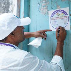


When the super cyclone Amphan made landfall in Bangladesh in May 2020, 55,000 houses were destroyed in the country. Wasim Ali, 45, lived in one of them. The tidal surge that the storm whipped up swept away his house and razed his small one-acre farm in Protapnagar in Bangladesh’s southwestern Satkhira district. Tens of thousands of people were left destitute after this massive natural disaster. But misery runs deeper for Wasim.
In addition to the loss of his home and farm, the disaster also left him with no way to pay back a debt of 42,000 Bangladeshi takas ($440), an amount he’d borrowed from a bank as an agricultural loan. He’d pledged his farmland as collateral, and says he’s now afraid to face the bank’s officials.
“I can barely support my family of five on the small piece of land I managed to squeeze out since the disaster. It is impossible to repay the loan against a piece of land that does not even exist anymore,” Wasim says.
Collateral pledged wiped out
Nearly a third of Bangladesh’s total land mass lies in its coastal zone, spanning 47,201 square kilometers, according to a study. This zone is home to about 35 million people, or 29% of the country’s population.
These communities are heavily dependent on agriculture, working on their small, fragmented lands. In a form of short-term assistance, the government makes available up to 50,000 takas (about $530) in agriculture loans to individual small farmers, disbursed through commercial banks.
These loans carry interest rates ranging from 5-10% for a single crop season, depending on the bank and the type of crop, and farmers are meant to pay back the principal plus interest after harvest.
, and the zone is home to about 35 million people, or 29% of the country’s population. Credit: Maksuda Aziz/Mongabay.")
Although the loan amounts are small at the individual level, collectively, agricultural loans make up a major part of Bangladesh’s banking activity. The country’s central bank says agricultural loans for the year to May 2022 amounted to 284 billion takas ($3 billion).
That constituted 20% of all loans distributed in the nation during that period. One agriculture-focused lender, state-owned Bangladesh Krishi Bank, disbursed 200 billion takas ($2.1 billion) of those farm loans.
For these banks, however, the coastal regions are a headache: farmers here are increasingly defaulting on their payments as a result of climate change-induced natural disasters.
According to Bangladesh Krishi Bank, the two most affected subdistricts of Satkhira – Assasuni and Shyamnagar – have outstanding loans totaling 78.1 million takas ($822,500 million), disbursed from its three branches in Assasuni, Gunakarkathi and Shyamnagar.
Another state-owned lender, Agrani Bank, has 15 million takas ($158,000) currently on its books from two of its branches, in Assasuni and Shyamnagar.
In a visit to Assasuni, where Wasim Ali’s house and farm were destroyed by Super Cyclone Amphan, Mongabay met several other individuals in similarly dire situations.
Hasan Mollah has been classified a defaulter since another cyclone, Aila, hit the region more than a decade ago, in May 2009.
“After losing the land, I lost my home and source of income. To provide for my family, I was forced to move to the city. Even so, I was unable to come up with the 38,000 takas [$400] to pay back the loan,” Hasan said.
The central bank has since 1991 made concessions for farmer-borrowers like Wasim and Hasan who have been hit by natural disasters. These free them from interest payments as long as they repay the principal sum.
“Banks operate as a business by lending loans, so it cannot lose its capital,” Bangladesh Krishi Bank managing director Md Ismail Hossain told Mongabay. “We have rescheduled loans and still have 21.3 million takas [$224,300] in that area that is classified,” or on the books.

Land loss
A third of Bangladesh sits just 1-4 metres (3.3-13.1 feet) above sea level, and 80% of the country is a floodplain. The southwest coast, including the district of Satkhira, is less than 2 metres (6.6 feet) above sea level.
That makes every millimetre of sea level rise a cause for concern in this densely populated region. Scientists estimate that by the year 2100, global warming will contribute to sea level rise of 0.5-2 metres (1.6-6.6 ft). That would leave most of Bangladesh underwater.
For the time being, the Sundarbans, the world’s largest expanse of mangrove forest, are protecting the southwest coast of the country. But increasingly frequent and intense cyclones are bringing strong tidal surges that threaten to break down the resistance of the mangroves.
In Protapnagar, where Wasim Ali lives, a series of storms from 2019-’21, including Amphan, has rendered some 20 hectares (nearly 50 acres) of land permanently underwater, according to findings from the Center for Environmental and Geographic Information Services, a government research institute.
The storms are also threatening another water-based disaster. The Water Development Board, responsible for safeguarding the country’s dams, says the Kholpetua River embankment, which runs through Shyamnagar and Assasuni subdistricts, has been weakened by repeated battering from storms.
After Cyclone Yaas hit in May 2021, the agency undertook an emergency repair of nearly 12 km of embankment in Protapnagar, and nearly 5 km in Padmapukur in Shyamnagar.
 above sea level. Scientists estimate that by the year 2100, global warming will contribute to sea level rise of 0.5-2 m (1.6-6.6 ft), which means the coastal region will be underwater. Credit: Maksuda Aziz/Mongabay.")
“The whole embankment is in a vulnerable state as it was built around 60 years ago,” said Shamim Hasnain Mahmud, an executive engineer with the Water Development Board. “The cyclones are speeding up its decline.”
According to Bangladesh Meteorological Department data, the southwestern part of Bangladesh faced at least eight cyclonic storms between 2000 and 2020. Four were categorised as severe to very severe, driving storm surges as high as 6 metres (20 ft). Three of those – Fani in May 2019, Bulbul in November 2019, and Amphan in May 2020 – hit within the space of a year.
Cyclones may be a regular phenomenon in the funnel-like structure of the Bay of Bengal, but climate change is making the storms more devastating. Warming sea surface temperatures increases the maximum potential energy that a storm can attain. And this past May, the water temperature in the Bay of Bengal hit record highs, according to Nasa, or the National Aeronautics and Space Administration.
Storms with more power and water unleash more rain and raises sea levels, allowing tidal surges to rush farther inland. That’s why places like Protapnagar, 80 km from the Bay of Bengal, get battered by cyclones like Amphan.

Banks fail when farmers fail
The Center for Environmental and Geographic Information Services predicted that between 2021 and 2023, the Padma basin is vulnerable to 1,215 hectares of river erosion.
The United Nations disaster reduction agency estimates that Bangladesh’s average annual disaster losses could amount to $3 billion, or up to 2% of the gross domestic product, or GDP, according to a 2021 World Bank report.
In addition to its baseline losses from climate hazards, Bangladesh is likely to incur additional costs from climate change by the middle of the century. If mitigation efforts are not stepped up, this figure could increase to 9% of GDP by the end of the century.
Golam Rabbani, head of the Climate Bridge Fund Secretariat at development the non-profit BRAC, said the true amount of loss and damage will be much higher.
“It took five years to wash the saline off the soil after Cyclone Aila [in 2009], thus restoring rice production to pre-Aila levels, found a study,” he said, adding that loss and damage estimates only consider the immediate effects. “Data on migration or alternative forms of employment are not kept in the affected areas.”
Hossain, the banking director, said that since a bank branch’s profitability depends on local borrowers’ economic well-being, both migration and the loss of livelihoods are detrimental to the bank’s operations. “Banks also fail if they fail,” he said.
This article was first published on Mongabay.