


On September 24, a major landslide hit a water pump at Chaba in the Shimla district of Himachal Pradesh and reportedly damaged a pipeline worth Rs 5 crore that supplied water to the district.
Earlier in June, relentless rains led to deadly landslides in Manipur’s Noney district, killing more than 53 people and leading to multiple casualties in the form of damage to property and displacement.
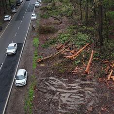
Landslides are an annual occurrence during monsoons, but developmental activities and the climate crisis have been increasing the risk of these disasters. In 2022, 10 states reported 182 landslide-related fatalities across multiple districts in the monsoon, according to data available with the Ministry of Home Affairs’ National Emergency Response Centre until September 2022.
“Landslides are very common during heavy rainfall or cloudbursts,” said Sridhar Balasubramanian, faculty at the Interdisciplinary Programme on Climate Studies Centre at the Indian Institute of Technology, Bombay. “A robust and reliable early warning system would definitely help in planning, management and saving lives.”
While initiatives have been taken to develop landslide susceptibility maps over the last decade, experts note that these maps lack the ability to precisely identify when and where landslides will occur.
A #landslide was reported along Mumbra Bypass Road in #Thane even as #Mumbai and surrounding regions continued to be pelted by heavy rains. No injuries were reported. #MumbaiRains pic.twitter.com/z34HMxCuXz
— Hindustan Times (@htTweets) July 5, 2022
Scientists at the Geological Survey of India, a scientific agency established under the Ministry of Mines to conduct geological surveys and studies of India, in collaboration with the British Geological Survey, have been evaluating a prototype to predict landslides in the Darjeeling district of West Bengal and the Nilgiris in Tamil Nadu. If the model proves successful, it is likely to be deployed in some parts of India as early as 2025.
But even as the work progresses, scientists and experts we spoke to pointed to multiple technical challenges that can get in the way of a reliable prediction of landslides. “Early warning systems for landslides are very different from early warning systems for cyclones or floods,” said a senior National Disaster Management Authority official, on the condition of anonymity.
“You cannot have an early warning system for landslides without active monitoring. So I am not sure if we can ever develop an early warning system for landslides, the way we can for floods, droughts and cyclones.”
Referring to the Geological Survey of India’s prototype project, he said “We cannot attest to the reliability of such a system. There would certainly be differences in predictions.”
IndiaSpend.com reached out to the Geological Survey of India on August 26, 2022 to learn more about their development of a landslide warning system. The Geological Survey of India is yet to respond. We will update the story when we receive a response.
The landslide problem
Landslides are among the major hydro-geological hazards that affect large parts of India, particularly in the Himalayas, the Northeastern hill ranges, the Western Ghats, the Nilgiris, the Eastern Ghats and the Vindhyas. About 12.6% of India’s total land area, excluding snow-covered areas, is susceptible to landslide hazards, according to the Geological Survey of India.
Between 2015 and 2022, over 3,782 landslides have occured in different states and Union Territories, the Ministry of Earth Sciences reported during the monsoon session of Parliament. The highest number – 2,239 landslides – were reported in Kerala, followed by West Bengal with 376 landslides.
Landslides are largely reported to have been triggered by natural causes such as earthquakes or heavy rainfall. But human activity such as construction of roads, buildings and railways, mining and quarrying, and hydropower projects also damage hilly slopes and impact natural drainage by removing soil and vegetation, loosening soil and gravel, and making the hills more susceptible to landslides, IndiaSpend reported in October 2020.
Further, severe, unpredictable weather events such as heavy, intense rainfall due to the climate crisis add another layer of complexity to landslide incidents in the country.
Kerala | A landslide occurred at Kundala estate in Munnar in Idukki district last night. No casualties were reported. A temple & two shops damaged under the debris pic.twitter.com/obG3I83iuj
— ANI (@ANI) August 6, 2022
The Ministry of Earth Sciences informed Parliament in July 2022 that unprecedented high rainfall is one of the major triggers of landslides in India. Infact, weather-related events were responsible for 95% of all disaster displacement in Asia between 2010-’21, according to a study published on September 19, 2022 by the Internal Displacement Monitoring Centre and the Asian Development Bank. The study also revealed that between this period, as many as 1,52,000 were displaced by weather-related landslides in South Asia.
Maps short on accuracy
In 2013, the Himalayan state of Uttarakhand faced one of its “worst disasters”, when glacier melting and cloudbursts destabilised land at an elevation of 5,600 metres, inflicting heavy damage and killing nearly three dozen people. While the disaster essentially occured due to natural causes, it was enhanced manifold by anthropogenic activities such as hydropower projects, per a 2013 National Institute of Disaster Management report.
Five years before the Uttarakhand disaster, the National Disaster Management Authority had put together a set of Guidelines on Management of Landslides and Snow Avalanches. These included, among other things, building a database of landslide-prone areas through zonation mapping and geological and geotechnical investigation of vulnerable slopes and existing landslides.
“When infrastructure development takes place on slopes, the area by default becomes more prone to landslides,” said a senior National Disaster Management Authority official. “So the authorities responsible for the infrastructure need to conduct their own risk assessment on these slopes and convey it.”
“Even though the guidelines were issued in 2009, progress by way of their implementation was limited in landslide-affected states/UTs,” the National Disaster Management Authority admitted in its own 2021 report.
VIDEO: At least 34 people were killed in Mumbai, India's financial capital, after heavy monsoon rains triggered a landslide and the collapse of a wall pic.twitter.com/LBsngGx7ZA
— AFP News Agency (@AFP) July 19, 2021
After the 2013 disaster, the Geological Survey of India launched the National Landslide Susceptibility Mapping project. Under it, Geological Survey of India prepared a landslide susceptibility map of 85% of the total target area (3,63,000 square km out of 4,20,000 square km) in different landslide-prone states and Union Territories. For this, Geological Survey of India also collected historical data covering 86,459 landslides.
“Earlier we had 1:50,000 resolution maps, now we have susceptibility maps at 1:10,000 scale,” said the National Disaster Management Authority official. “But we will have to continue to improve resolution, by say 1:5000 scale, to make it more accurate and granular.”
States have also been independently working to develop their own susceptibility maps. For instance, Mizoram’s capital city Aizawl has taken a lead over other hill towns and developed a landslide action plan using 1:18,000 scale susceptibility maps, besides enacting regulations to guide construction activities. Kerala has also prepared an action plan giving high priority to landslide hazard zonation maps in hilly areas at the municipality and panchayat levels.
But experts pointed out that the susceptibility maps are based on a probability model, which is a mathematical representation of the probabilities associated with the event happening in an area. “Landslides are very specific to a region,” noted Balasubramanian of the Indian Institute of Technology, Bombay. “Our main challenge is forecasting on a local/hyperlocal scale. A district-wide or division forecast is of no use.”
Udit Bhatia, an assistant professor of civil engineering at the Indian Institute Technology, Gandhinagar, who worked on rainfall-induced disruptions along the Periyar river basin, noted, as an example, that the “Periyar river basin is part urban, part of it is covered in forest and part of it is covered in a significant mountain region. So an incident of a landslide is very specific in space and time.”
Unreliable monsoon
Early warning systems have been recognised as an effective tool to reduce vulnerabilities and improve preparedness and response to hazards, according to the United Nations Development Programme.
The Sendai Framework for Disaster Risk Reduction (2015–’30), an international document adopted by United Nations member states in 2015, requires countries to set out an early warning system with a multi-hazard approach by 2030.
“Rainfall has been one of the major trigger events for landslides in India. The early warning system for landslides would only be as good as rainfall forecasting,” noted Balsubramanian. Knowing rainfall patterns is critical to understand which areas should be prepared for these (landslides, flooding, etc) kinds of impacts, added Bhatia.
Monsoon in the Indian subcontinent usually starts between late – May and early – June, but in the last couple of years it has become more erratic because of climate change, IndiaSpend reported in October 2022. Over the years, such uncertainties in the monsoon will only increase.
“Forecasting monsoon for the short term and long term is a complex phenomenon and there is no magic wand that will give you a perfect answer, every time,” said Bhatia.
Until 2021, the India Meteorological Department, an agency under the Ministry of Earth Sciences, and responsible for weather forecasting, used a long-range forecast method which predicted the quantum of total rainfall from June to September in two stages – first, in the third week of April, and then in the second week of June.
But much of this forecast was based on a statistical model that would rely on historical monsoon data coupled with atmospheric patterns, like El Nino or La Nina. However, an India Today study found that monsoon predictions using this model have gone wrong for many years.
In 2021, the India Meteorological Department updated its model to improve monsoon forecasting based on the Multi-Model Ensemble forecasting system. Based on sea surface temperature over the Pacific and Indian oceans, the model forecasts for the country as a whole, and for four homogeneous regions.
“Year after year, our understanding of monsoons is improving as we develop more data and more models,” said Bhatia. “The model [Multi-Model Ensemble model] developed by the Indian Institute of Tropical Meteorology, Pune, and a European University specifically focuses on improving our forecasts for Indian monsoons at different temporal resolutions. So things are improving.”
We reached out to the India Meteorological Department for their response on monsoon forecasting in India on September 20. We will update the story when we receive their response.
Pilot projects
Independently, different academic institutions have been developing their own pilot models. In 2018, Coimbatore-based Amrita Vishwa Vidyapeetham set up real-time landslide monitoring and early warning systems in Munnar (Kerala) and Sikkim. The multiple sensor-based system analyses rainfall infiltration, pore water pressure (pressure of groundwater held within soil), vibrations, movements, and slope instability.
“Developing a pilot project means we start with some theory which we think would work, and generalise for different regions,” said Bhatia. “If they are successful, they give us some confidence to be able to apply it to diverse geographies.
“When we have multiple pilot projects doing that validation, one for the Western Ghats, one for Himalayas, etc, then we have an envelope of models which we call “mixture of experts”. So rather than relying on one single model, we get a mixture of experts that do the job they are best at doing.”
In another such project, the Indian Institute of Technology, Mandi, has also installed surface-level motion-sensor-based early warning systems for landslides at 10 locations in Mandi district of Himachal Pradesh. The device collects weather parameters, soil moisture, soil movement and rainfall intensity.
When the device detects a significant displacement of earth which could result in a landslide, it alerts the officials. In 2018, the sensors successfully alerted officials about an impending landslide on the Mandi-Joginder Nagar highway. This helped the police turn away vehicles from the road before it was washed away.
In 2018, the first set of landslide monitoring systems was deployed in the field on a trial basis by the district administration, Mandi, said Varun Dutt and KV Uday, associate professors at the Indian Institute of Technology, Mandi, who leads the project.
However, due to lack of awareness on the site, the systems installed faced the issues of vandalism and theft. This became a set-back on scaling the systems to higher quantities, which was solved in further years in consultation with relevant departments, and by spreading awareness.
In 2022, the Indian Institute of Technology, Mandi, boosted up the system to a few more districts in Himachal Pradesh. “While we are looking forward to installing more systems in the days to come, lack of awareness, funding limitations and the tedious purchase process have been some of the limitations for the scaling up of the technology,” noted Dutt.
As seen above, various institutions – both government and private – are working towards developing viable early warning systems to mitigate the devastation caused by annual landslides across the country. Equally, however, it is clear that thus far, such projects are few, far between and not yet up to scale – all of which adds up to the possibility of more destruction from disasters in the immediate future.
IndiaSpend has reached out to all concerned agencies asking about their progress in forecasting landslides and developing early warning systems. We will update the story as and when we receive responses.
This article was first published on IndiaSpend, a data-driven and public-interest journalism non-profit.