


One day in July 2022, a group of children in Shikarpur, a village in Delhi, ran towards Gulshan Tyagi. “Are we under an attack, uncle?” they asked playfully, explaining that they had seen a drone flying over their village. Tyagi, a resident of the village, ignored them.
It was only two years later, when he saw a public notice on a wall of the village temple, that Tyagi realised what the drones had been used for.
The notice explained that as part of the implementation of the Svamitva scheme in the district of South-West Delhi, a map of Shikarpur had been created based on a drone survey, and that a list of properties in the village had been prepared. It stated that the map was displayed at the temple and in the chaupal, or village square. Further, it said, before the map and the list were finalised, “the village is invited to submit their claims and objections, if any, within 15 days of this notice”.
That was the first time Tyagi and others had heard about Svamitva.
The scheme’s name is an abbreviation of Survey of Villages and Mapping with Improvised Technology in Village Areas. It was launched by the central government in April 2020 with the aim of resolving a longstanding problem: in large swathes of rural India, the only land records that people possess are of farmland. Most have no property ownership records for their homes. Effectively, most people in India live in homes and other private property without any documentary proof of their ownership.
To address this, the government decided to survey inhabited regions of rural areas, and provide residents with property cards or other legal documents that could serve as proof of their property.

The drone survey and the creation of maps were the first steps of this process. Next, on digital copies of the map, officials of the land revenue department would mark with yellow rectangles what appeared to be private property, and with red rectangles what appeared to be public property, like roads, schools and temples. They would then visit mapped villages to verify that the categorisation of properties was accurate, and obtain information about those who owned individual pieces of land.
Based on the information thus gathered, the department would issue documents of ownership to residents of villages, and update decades-old government land records. The mapping and verification exercise was also intended to help resolve property disputes across the country by providing some clarity about the occupation and ownership of land.
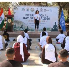
Since its launch, the government has budgeted more than Rs 500 crore for the scheme. As of January this year, drone mapping had been completed in over 3 lakh villages across 31 states and union territories. On January 18, Prime Minister Narendra Modi issued 65 lakh property cards to residents of more than 50,000 villages across the country. “Our government through the Svamitava yojna has made the people of our villages so capable that it can completely transform Indian rural life,” the prime minister said while issuing the cards.
Despite the fact that massive resources have been directed towards the scheme, many residents of villages across the country have concerns about its implementation.
In Shikarpur, Tyagi and other residents did not find the map and other information in the temple or the chaupal, and had to approach the tehsildar to obtain the documents. When they did, they realised that data for 56% of the houses that had been identified in the survey was riddled with errors.
These ranged from basic spelling mistakes in the names of owners, to more grievous errors, such as the allocation of four different plots to one individual named Suresh, though no such person lived in the village.
Other errors included the allocation of the homes of three neighbouring brothers under one brother’s name, and the addition of the prefix “late” before the name of a living owner. “Imagine if these were placed in the permanent records, it would create so many conflicts among families in the future,” said Narendra Tyagi, a resident of Shikarpur.

Shikarpur’s experience is not an isolated one – Scroll’s reporting from Delhi and two other states has revealed that problems with the scheme are widespread. In Gujarat, we found an instance where personal property had been marked as a public road. In Jharkhand, residents of Khunti district, angry that officials had neither informed them about the scheme’s objectives nor consulted the gram sabhas, forced the government to halt the survey process.
“The significant pressure on officials to meet deadlines has meant that in many cases the scheme has proceeded without the full consultation of villages,” said Tom Cowan, an associate professor at Nottingham University who has been researching Svamitva for the past three years.
Cowan also pointed to a deeper problem in the way the government had conceptualised Swamitva. “The scheme views land through a singular financial lens, the aim is solely to turn the land into a credit-worthy asset, available for loans.” But land in India, especially in states with tribal populations, is often owned and used collectively, by a family or a community. “None of these uses and rights are included under the scheme,” he said. “None can be picked up by an aerial image on a drone.”
This story is part of Common Ground, our in-depth and investigative reporting project. Sign up here to get the stories in your inbox soon after they are released.
In early December, Shikarpur was surrounded by golden-yellow mustard fields.
At the centre of the fields was the inhabited area, also known as “abadi” land, which included houses, shops and a temple.
In the late 1970s, the government, in keeping with the Land Reforms Act of 1954, carried out surveys of this agricultural land to determine ownership of different tracts.
The inhabited area, however, remained unsurveyed. “We were staying at our homes without really owning them,” said Rupal Tyagi, another resident.
The lack of legal documents to prove their ownership of the land they live in has meant that residents have not been able to use their properties as financial assets – for instance, to mortgage them while seeking loans from banks.

Svamitva aimed to provide property owners with such recognition of ownership through a time-bound process.
Mapping for the scheme is carried out by the Survey of India, the government department broadly responsible for surveying and mapping land in the country. Officials first check available maps to identify inhabited rural areas, where property records need to be established. Once a particular village is identified as a location where the scheme is to be implemented, the department has to provide information about the scheme to its gram panchayat representatives. Under the scheme’s guidelines, the gram panchayat must within two weeks conduct a meeting to inform residents of the schedule of the survey, and provide inputs to the revenue department officials about its plans for flying drones, and other processes under the scheme.
Within a week of this meeting, revenue officials have to carry out drone surveys and number properties on a map generated based on the surveys. By the end of the month, the revenue department has to carry out “ground-truthing”, to identify owners of different numbered properties. Wherever available, older land data, from sources such as panchayat-level records, are also to be used for verification.
After this, before the final map is prepared, the map and the list of owners has to be made available to the village panchayat, and villagers have to be given at least 15 days to file objections or point out errors. Following this step, property cards are issued to residents. Some states have prescribed a fixed time to be taken between the survey and card distribution – for Madhya Pradesh, for instance, this time period is eight months.

Officials that Scroll spoke with in Delhi and Gujarat noted that the speed at which the process is expected to be completed is a challenge, since the work requires considerable manpower. Referring to the ground-truthing process he was involved in in one village, a revenue official in Delhi noted, “Ten days to complete verification of 400 houses is hard to do.”
Researchers see this as a design flaw.
“The significant pressure on officials to meet deadlines has meant that in many cases the scheme has proceeded without the full consultation of villages,” said Tom Cowan, an associate professor at Nottingham University who has been researching Svamitva for the past three years.
Scroll’s reporting also indicated that this was the case – though the policy guidelines mandate the involvement of the gram sabha, and require that residents’ permission be taken before the mapping process is initiated, on the ground, these steps were not given much priority.
“They conducted the drone surveys in a very covert manner,” said Jaimangal Munda, gram pradhan of Duphu village in Jharkhand. “The authorities never attempted to contact us and inform us about the purpose of the drone survey.” Munda participated in protests in Karra and Torpa blocks of Khunti, where people refused to let the implementation process go ahead.

In Shikarpur, Narender Tyagi noted that officials informed villagers that the drone survey was being carried out “for a sewer line that had to be constructed”.
For Cowan, this pattern of limited or misleading consultations with locals is worrying. “This has effectively meant that the crucial process of allocating rights is often left up to the interpretation of officials, sometimes sat in faraway offices,” he said.
A 2022 report on the scheme by an expert committee of the government that included representatives from Niti Aayog and the School of Planning and Architecture made a note of this. Under the sub-heading of “issues faced during digitisation”, it stated that after the drone image was captured, the “quality of extraction of boundary depends on the interpretation of the person involved in the process”, and that there had been cases of “misinterpretation of boundaries”.
On a cold December morning, Gulshan Tyagi stood on a street in Shikarpur where surveying errors had been found in four houses. “The names of the owners of these houses are jumbled up with each other,” Tyagi said. “The first plot is in the name of the second plot’s owner, and so on.”
Tyagi played a crucial role in ensuring that these errors were identified. In November 2024, two years after the revenue department carried out drone imaging in the village, and a few days after it put up a notice calling for objections and rectifying errors, Tyagi procured a copy of the numbered map from officials and pasted it on a wall in his shop. Then, he invited residents to inspect the map and check if plots had been assigned to owners correctly.
A plot of land belonging to Narender Tyagi was among those whose records contained errors – though he had bought the plot in the village in 2017, the Svamitva survey had recorded the name of the previous owner.
In all, over three days, the villagers discovered that of 482 houses, records for 272 contained errors. The villagers documented the errors and informed the revenue department of them, attaching documentary proof wherever available to support their claims. The revenue official told Scroll that the department had received the corrections from the village and had made note of them before sending the final list ahead to the centre.
Over 1,000 km away, residents of Pipli, in Gujarat’s Ahmedabad district, grew distressed in 2022 as revenue officials began marking plots with choona, or limestone, a step intended to make demarcations of property clearer for drone imaging.
They realised that the officials were making numerous errors in their markings – for instance, one resident’s personal property was being marked as a public road.
In the neighbouring village of Shela, residents said that after the survey, the revenue department did not share the map that had been created with them at all.
Instead, the department sent panchayat secretary Sanjay Jadav a document for each household in the village, which officials referred to as “form 6” – it contained details such as the name of the property owner and the size of their plot. But instead of providing details of the property’s location in the village, it merely contained a diagram of a polygon indicating the shape and size of the property.
“It was like a sample of what the property card would look like,” said Jadav. Residents were required to check this information for accuracy and inform the department in case they found any errors.
But Jadav noted that without an aerial map that placed a resident’s plot in relation to others, “We cannot check if the marking of one’s plot is correct or not.” Thus, for instance, the documents did not help villagers determine whether there were conflicts in plots demarcated to different owners.

Shela’s residents’ apprehensions about the survey were exacerbated by past experiences with a rural land survey.
In 2017, Shela and Pipli, were part of the union government’s Digital India Land Records Modernisation Programme, under which agricultural lands in rural areas were resurveyed so that old land records could be updated and digitised. The maps that were prepared during that resurvey contained significant errors. “If someone owned 20 bighas, the map recorded it as two bighas,” said Narender Chawda, resident of Pipli and a member of the taluka panchayat. He added, “Someone owned a piece of land about 7 km away from their house, and that got recorded as a public road.”
Such errors, and the government’s response to villagers’ concerns over the survey have left them wary of the new survey. “We have been following up on these errors since 2017, and none have been fixed,” Chawda said. “When the drone survey for Svamitva was being done, this was our biggest fear, that similar mistakes would happen.”
Residents of villages in Jharkhand, too, recounted that records generated under the earlier scheme contained major errors. “Ten acres of my land have been put in another person’s plot,” said Latwa Munda, a farmer from Bamarja village. He realised that his land had been marked off as someone else’s in 2023 when he went to pay property tax. “I have documents to prove that the land is mine but the officials made me run around for six months to correct this error, but nothing happened. I finally had to register a case about the issue.”
Scroll emailed queries about concerns with the scheme to the revenue departments of Delhi, Gujarat and Jharkhand. This story will be updated if any responses are received.
Researchers have also critiqued the Svamitva scheme for focusing on private property, while neglecting to account for other kinds of relationships between people and land.
This is particularly significant in many parts of Jharkhand, which have long had traditions of community use of land.
This community use of land, specifically two systems known as the Mundari Khuntkatti and Bhuinhari land tenures, is recognised by Chhotanagpur Tenancy Act. The act acknowledges that the original settlers of the land – the Munda and Oraon Adivasi communities – have customary community rights over it, such as the right to reclaim “wasteland” and convert it to cultivated land.
A 2024 report titled “Save the Khatiyan, Save the Land” by Ranchi-based research centre Bagaicha, wrote that these land systems “cannot be classed in the language of private property regime or as subject to the doctrine of eminent domain”, or the government’s right to take over private property for public purposes.
Thus, activists in Jharkhand are concerned that Svamitva only seeks to map private property.
“Our community land is for collective use. It is not enlisted under one person’s name,” said activist Dayamani Barla, a member of Khatiyan-Jameen Bachao Sangharsh Morcha and author of the report. “The Svamitva scheme would have been another way for this land to be declared as nameless property which can be given to corporate houses.”
The broad term for land that is used by the community collectively is gair majurua land – such land was allocated for communities by their ancestors, for a variety of purposes, such as for grazing animals, to set up a worship site or burial grounds, or community centres. Some lands were even demarcated as sites for future generations to populate.
In 2016, the Bharatiya-Janata-Party-led state government had set up a “land bank” project, under which it sought to identify tracts of land across the state that were vacant and could be used for commercial purposes. Even then, activists and researchers alleged that gair majurua land and various other kinds of land that were already in use were being added to the land bank.
In Gujarat’s Zankhi village, too, residents have similar fears of the loss of commons land. The village has some plots of land that are “open”, said Payalben, resident of the village and member of the Working Group for Women and Land Ownership, which works on land rights of women in the state. She explained that the community had an agreement that apart from grazing, parts of such commons land could be used by some families to farm vegetables in the monsoon. “When our sarpanch heard about Svamitva, he did not give permission to fly drones because he feared these lands would be taken away by the government,” she said. Like Zankhi, ten more villages in Ahmedabad district refused to let the scheme be implemented.
This included Pipli, whose residents raised concerns about the scheme with the revenue officials when they visited the village to conduct drone mapping. “We kept telling them that before you fly the drone, at least tell us which parts of this land are officially government land and which can be considered people’s private land,” said Chawda. “We asked them to explain the scheme to us. But they just told us that the map is not permanent and that we would be given a chance to point out the errors later.”
 a resident of Pipli and a member of the taluka panchayat explained that an earlier survey had been riddled with errors, making residents of the village wary of the Svamita surveys also. Photo: Vaishnavi Rathore")
Though officials flew drones over the village that day, no further steps in the implementation have been completed since. An official in Ahmedabad’s District Inspector of Land Record office, who worked closely on the scheme said in the cases where villages have protested against the process, implementation of the scheme had been paused for now.
Residents of different villages raised concerns that certain groups would be excluded from the scheme.
In Gujarat, while deciding on the name in which a property card should be issued, revenue officials implementing Svamitva are depending on panchayat-level records of land, known as akaani. In many cases, these records have not been updated and bear the names of owners of a previous generation – members of younger generations, thus, fear being left out of records.
“In our village, the akaani has not been updated for ages,” said Payalben. “Last year, I wanted to get my brother and my name added and updated under our father’s name, but the sarpanch so far has not completed that work.”
She added that under the patriarchal system, women struggle to have their names added into their families’ land documents.
The official at the land record office confirmed that the government would rely on akaani records. “Only those registered in akaani will get the property cards,” she said, adding that they were aware that in many cases, only one brother in a family of many, or a father, had their name registered in the akaani, which could result in other family members being denied property cards. “In case there are more holders, they will first have to get it added in the panchayat land records,” the official said.
But this could be a challenge now, Shela’s sarpanch Arvindbhai Gohel said, since in many cases the ownership lists for Svamitva have already been prepared based on the akaani. In his district, for instance, the revenue department has completed the lists for 300 of the approximately 430 villages under the scheme.

Cowan noted that because the scheme did not take into account the use of common lands, there was a risk it would exclude communities that did not own land, who were often the primary users of such tracts. “Commonly, Scheduled Castes will have their land on common lands, or outside the abadi land, and they would be excluded from the scheme,” he said.
He added, “Land is already subject to a great deal of inequality. Rather than addressing these inequalities, the scheme further inscribes them.”
In Delhi’s Shikarpur, when the final map was prepared, a colony inhabited by Scheduled Castes was marked on the map, but all its houses had been recorded as belonging to a single individual. Gulshan Tyagi later learnt from a surveyor that it had not been surveyed at all.
Errors like these have left residents of villages across the country wary of the policy and its implementation. “See, the centre took out this policy with a lens of all India level,” Chawda said. “But they don’t understand the localised problems and challenges of such land record digitisation in villages.”
Tyagi argued that when it came to officials implementing the policy, “hawa mei teer mar rahe hai” – they were shooting in the dark.