


With days to go for Bangladesh Prime Minister Sheikh Hasina Wajed’s visit to India starting Friday, the suspense grows. Will they sign the contentious Teesta Water Sharing Agreement?
Hasina suggested they won’t. Other reports from Dhaka predicted that President Pranab Mukherjee would put his weight behind it and bring the chief ministers of five states bordering Bangladesh – Assam, Tripura, Mizoram, Meghalaya and West Bengal – together for a meeting with Hasina. The plot thickened as reports from this side of the border suggested that Dhaka would play the China card, involving Beijing, which has long-running water disputes with Delhi.
Meanwhile, domestic tangles remain. Last month, West Bengal Chief Minister Mamata Banerjee said the Centre had made no attempt to reach out to her on the agreement, prompting the foreign ministry to make public assurances that she would be consulted. In 2011, Banerjee had pulled out of then Prime Minister Manmohan Singh’s visit to Dhaka, scuppering the deal at the last minute.
Far from the current of political negotiations, between Dhaka and Delhi, between Centre and state, lies a strained and drying river that flows through desperately poor populations. Instead of being seen as a zero sum game between two countries, recent research suggests the Teesta dispute could be broken down into a complex of local problems affecting people on either side of the border.
Rapidly flows the Teesta
The Teesta springs from the Khangchhung Cho, a glacial lake in Sikkim, at an altitude of 5,280 metres. It flows rapidly through Sikkim for about 151 km, fed by tributaries joining it on the slopes, then 142 km along the Sikkim-West Bengal boundary as well as the plains and foothills of West Bengal, and then into Bangladesh, where it travels 121 km before meeting the Brahmaputra.
Altogether, the Teesta river basin covers 12,159 square km and thousands of villages. Any agreement would affect the lives and livelihoods of millions of people living in these areas. In Bangladesh alone, about 21 million people depend, directly or indirectly, on the river for their livelihoods. India, the upper riparian country, largely controls how much water Bangladesh can access.
According to an agreement signed by the two countries in 1983, India could use 39% of the river waters and Bangladesh 36%. The remaining 25% was to be allocated after further study. A joint committee of experts was formed in 1997 and a joint technical group in 2004 to decide on allocation. Neither yielded a viable formula to share lean season flows.
As India-Bangladesh ties grew warmer, the two prime ministers released a joint communique in 2010 that the Teesta water sharing issue would be resolved soon. According to some reports, the agreement was to have divided the lean season flow 50-50 between the two countries, leaving aside 20% of the total flow of the river.
The deal was reportedly scuppered because Banerjee did not want to cede more than 25% of the flows to be shared. But in Bangladesh, the facts were cloudy. While the foreign affairs secretary in 2011 is said to have declared that Dhaka would make no more concessions, the advisor to the prime minister reportedly claimed it would take 17 years to measure the total volumes of water flowing through the river and only then would an agreement be signed.
Dams and barrages
Over the years, the rushing waters of the Teesta have been harnessed for ambitious hydropower projects, mostly in the upper catchment areas of Sikkim and West Bengal. In other places, the river is diverted for irrigation.
According to an Asia Foundation report published in 2013, some 30 major hydropower projects have been planned on the Teesta, with a combined capacity of 5,000 megawatts. Six of them have been constructed in Sikkim alone. These involve the construction of large dams that divert river waters through tunnels and into powerhouses before they travel further downstream.

In the 1970s, the mammoth Teesta Barrage Project was initiated for irrigation, hydropower and navigation in the region. Barrages at Gajoldoba, in North Bengal’s Jalpaiguri district, and in two other places came up as part of this project. These were meant to water North Bengal’s tea gardens and fields of paddy.
Meanwhile, two more low dams are planned in Bengal’s Darjeeling district and the river has also been earmarked for India’s river-linking project, which aims to channel water from Himalayan and peninsular rivers to drought-prone regions farther south through a network of dams and canals.
Lower down the river, Bangladesh has its own Teesta Barrage Irrigation Project, meant to cover an irrigable area of 540,000 hectares.
Disease of gigantism
Needless to say, this “disease of gigantism”, as geographer Kalyan Rudra puts it, has proved to be a problem. Both Rudra, who conducted a study of the river commissioned by the West Bengal government in 2011, and the researchers for the Asia Foundation report point out the various hazards of such large-scale construction.
In Sikkim, Rudra pointed out, the so-called low and run-of-the-river dams do not strictly meet international criteria for such classification. The relatively large dams constructed in these areas threaten to submerge surrounding riverine forests and villages in a tectonically volatile area.
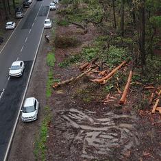
Apart from ecological threats, the projects have caused silting, depleting supplies of water as the river travels downstream. While the river has shrunk in some places, it tears away at its banks in others. Climate change and shrinking glaciers have compounded these problems.
Researchers for the Asia Foundation spoke to stakeholders at various sections of the river to find out how the impact of the Teesta mutates as it travels downstream. In Sikkim, they found residents troubled by shrinking supplies of drinking water and groundwater, affecting the cultivation of crops such as cardamom. While the dams had made the region prone to landslides, indigenous groups also worried about the fate of a river that had considerable socio-cultural significance in the region.
Lower down the river, in North Bengal, especially around Gajoldoba, villages on the riverbanks had been washed away by erosion and the flow of water had dwindled alarmingly, especially during the lean season. This depleted the water available for irrigation, which was usually cornered by the tea estates rather than smaller farmers. It also affected navigation on the river and reduced stocks of fish.
In Bangladesh, residents said projects upstream had reduced the water for the Teesta Irrigation Barrage Project and severely affected the livelihood of fishermen, who were forced to cultivate inadequate patches of land or move to other villages for work. Erosion had also eaten away the homes of people living on the banks and on the sand bars or chars in the middle of the river.
Gently down the stream
Apart from an agreement to portion out water to either country, experts have suggested means to relieve water shortages, contain ecological costs and the loss of livelihoods.
Rudra argued for the construction of several smaller, cheap dams instead of mega projects. To make up for power shortfalls, he pointed out that the amount of electricity lost in transmission could be reduced. It has also been suggested that the proliferation of tea gardens in North Bengal has taken place at the cost of agricultural land fertile enough for three crops.
Along large parts of the porous India-Bangladesh border, social and cultural ties persist. And researchers working for the Asia Foundation report found people in Bangladesh eager to solve the dispute amicably, recognising scarcities on both sides.
These ties and sympathies could be explored for a different kind of decision-making. The report argues for a process where the various stakeholders would be informed and involved. It could steer the dispute away from the brinkmanship that inevitably comes into play when governments, with political reputations at stake, negotiate a deal.