


Majuli is a picturesque island within the mighty Brahmaputra river in the state of Assam. It is the largest riverine island in the world, but as it is slowly eaten away, it may soon disappear.
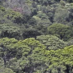
Given its size and location, the island is a biodiversity hotspot and an offbeat tourist destination. It specifically attracts birding aficionados as its fertile floodplains and highly productive wetlands provide an ideal habitat for a plethora of resident and migratory birds, up to 260 species.
Majuli also has a distinct cultural heritage, where tales of the Hindu god Vishnu are intertwined with local tribal lore. The island houses 22 Vaishnava Satras (monasteries).
Its unique location is also what is threatening the island’s existence. The Brahmaputra is one of the world’s greatest rivers, with fierce currents. Bank erosion has always been a problem, but the erratic flood pattern over the last few years has made it more of a problem. Majuli faced massive erosion due to the 2017 floods triggered by a breach of the Dhonarighat embankments created for the Ranganadi Hydropower project. The impact could have been limited if there had been timely, proper communication of the water release from the upstream state of Arunachal Pradesh.
A number of dams have now been sanctioned in Arunachal Pradesh, against which there have been protests in the state, but this has also raised concerns in Majuli. Geomorphological studies point out that the migration of the Brahmaputra and Subansiri rivers has badly affected erosion. Combined with this, the riverine island is a product of sand and silt deposits, but these deposits have become much less than the land carried away by erosion.
")
In sum, Majuli is facing extinction threats due to both man-made and naturally created factors. Its survival would depend upon implementing a holistic flood management plan by integrating scientific, technocratic and local knowledge.
Community concerns
Satellite imagery shows the landmass of the island has shrunk from 1,256 square kilometres in 1971 to only 524.2 square kilometres in 2016, losing half of its area. Sixty-seven revenue villages (a revenue village is a cluster of villages) have been completely eroded away by the might Brahmaputra.
These statistics raise questions on the survival of indigenous Assamese communities who live there, as well as their unique arts and culture.
“Apart from fishing, we largely rely on agricultural produce on Majuli’s char [land created by silt deposits] land for our sustenance. We mostly grow mustard and bao-dhan, a traditional deepwater paddy variety. I used to own 4 bighas [a bigha in Assam is roughly 1,320 square metres, or three-fourth of an acre] of land but now it has been reduced to 3.8 bighas. Also the floods get in more sand then fertile soil,” a middle-aged farmer in Kamalabari said.
Like him, many others in Majuli live under constant fear of land erosion, which has been one of the contributory factors for increased migration rates from this island. Monsoon season Brahmaputra flooding has also exacerbated the number of internally displaced people in this region.
Due to constant land loss, many farmers have become landless and are forced to live on the embankments in makeshift houses. They are under constant fear of deportation by the state government, as they do not hold any land rights to reside near the embankment areas.
")
Jamini Payeng, founder of the Rural Economic Development Society, is reported as saying that deforestation in the upper Himalayan region of Arunachal Pradesh has brought down huge quantities of sand in the lower riparian areas. This has badly impacted Majuli, as it has led to a rise in the Brahmaputra’s riverbed, and therefore to greater flooding. The haphazard construction of embankments on the upper riparian regions of the Brahmaputra has distorted the natural flow of river while the unmonitored flow of floodwater has resulted in extensive erosion of the island.
What is being done to save the island?
The Assam government has put forth a Assam State Action Plan on Climate Change (2015-2020). The section on climate change adaption speaks about the initiatives taken by the government to contain and adapt to floods and erosion. These includes river bank stabilisation, creation of embankments in strategic locations, the establishment of a flood warning system, extensive flood modelling studies to study the nature of the Brahmaputra, and the promotion for cultivation of flood-resilient paddy crops like Boro. The plan also includes the construction of an adequate number of flood shelters and other flood mitigation-related infrastructure.
")
The Brahmaputra Board has undertaken flood mitigation measures to save Majuli from erosion. These include the construction of boulder spurs, a reinforced cement concrete porcupine screen, riverbank stabilisation using geo-textile material and so on. The government claims that because of these restoration interventions, the area of Majuli Island has increased from 502 square kilometres in 2004 to 524 square kilometres in 2016.
Furthermore, Assam’s Department of Environment has launched a Sustainable Action for Climate Resilient Development in Majuli, which aims to make this island carbon-neutral by 2020 through forestry activities and biodiversity conservation. This plan stresses the importance of adopting bio-engineering means, community best practices and extensive afforestation techniques to combat the challenges to erosion.
What lies ahead
Even though several restoration interventions have been implemented in the last 15 years, there is little evidence of largescale recovery. Community interventions such as afforestation drives and the promotion of eco-tourism activities will only show long-lasting results if scientific interventions are closely interlinked with the larger development agenda.
As such, there is an immediate need to implement a holistic disaster management plan supported by sound budgetary allocations by the state and Central governments. This means giving more impetus to conducting studies to examine the geomorphological nature of the Brahmaputra and finding long-term flood mitigation solutions.
Clearance to large dam projects needs to be assessed properly for downstream impact, especially for dams planned on the Subansiri. This necessitates more dialogue between the riparian states to find common ground on flood-control measures and ownership acceptance.
Another key area of improvement is to enhance coordination, communication and information exchange between relevant departments in Arunachal Pradesh, Assam and Majuli. This would require the installation of flood-warning systems at critical nodes, facilitated by proper information flow and access in a timely manner.
Since the rate of land erosion is disproportionate to land restoration efforts, the need to create a holistic plan bringing together the various actors is urgent. Only then do we have a chance to save the world’s largest riverine island and its inhabitants – humans, birds, and animals.
Akshat Mishra is a Senior Research Associate at CUTS International. He is also the Founding Editor of Pathways to Development – Journalism about the environment, sustainability, and policy from researchers on the ground.
This article first appeared on The Third Pole.