


Cyclone Fani, classified by the India Meteorological Department as an extremely severe cyclonic storm, made landfall over Odisha between 8 am and 10 am on Friday morning. It weakened into a very severe cyclonic storm at around 11.30 am and is expected to move north along the coast towards Kolkata over the course of the day, even as it gradually reduces in intensity.
Fani is unusual for this time of year. While cyclones in the Bay of Bengal form between April and May and between September and December, cyclones of this severity usually develop in the latter half of the year.
As the meteorological department issued warnings to Andhra Pradesh, Odisha and West Bengal, the states began to prepare for evacuations and mitigating the cyclone’s impact. And on social media, users have been uploading videos and photographs of the storm, even as meteorologists share updates of satellite images and other tracking.

Landfall
When the cyclone made landfall south of Puri, its intense winds, gusting up to 180 kilometres per hour, uprooted trees and ripped off roofs. Videos shared on social media showed trees swaying and causing damage to structures in some places, including Bhubaneswar. According to NDTV, several areas in the coastal town of Puri were submerged due to the heavy rain.
Brother-in-law has sent this video of his backyard in Khurda, 35 kms from Bhubaneswar. One giant jackfruit tree, two of the coconut trees have uprooted. #CycloneFani #CycloneFaniUpdates pic.twitter.com/HdsMOIaQso
— Pratik Prasenjit | ପ୍ରତୀକ ପ୍ରସନ୍ନଜିତ (@pratikprasenjit) May 3, 2019
FANI impact in Puri pic.twitter.com/s88pqKhLbR
— PIB in Odisha (@PIBBhubaneswar) May 3, 2019
#CycloneFani @BBSRBuzz
— Asit Mohanty - ଅସିତ ମହାନ୍ତି (@Asit5) May 3, 2019
Visuals from Puri. Keep Praying. #JayJagannath pic.twitter.com/f8DmJyakOw
Odisha holds its breath as #CycloneFani makes landfall
— Rupashree Nanda (@rupashreenanda) May 3, 2019
Take a look at the furious #CycloneFani winds in the land of Lord Jagganath in Puri
Video sent by @dilipbisoi #CycloneFani pic.twitter.com/Cb5NukY89m
#CycloneFani at Grand road #Puri Landing speed - 180-190 kmph #Odisha Vis Courtesy Balaram #India pic.twitter.com/b5tUAU5hRS
— Asia News (@asianewsteam) May 3, 2019
Furious FANI
— PIB in Odisha (@PIBBhubaneswar) May 3, 2019
Sea Ingression near Chilika Coast in Khordha dist.@PIB_India pic.twitter.com/tK0dkX6Cet
Preparation for the storm
Meteorologists from the United States and other parts of the world have also been tracking the progress of Fani closely, tweeting updates about the cyclone’s path and its projected intensity. One user tweeted a timelapse satellite video of the cyclone developing over three days.
Severe Cyclone #Fani making landfall with Category 4 fury. #CycloneFani https://t.co/lpS6DLQXhR pic.twitter.com/qF3oMG7u1O
— UW-Madison CIMSS (@UWCIMSS) May 3, 2019
India from space for the past 3 days #CycloneFani pic.twitter.com/zNtmKDPqZW
— STOCKIE (@stockree) May 3, 2019
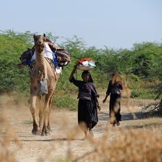
Evacuation
Government agencies have been sharing images of relief efforts and appealing to people to stay indoors and avoid stunt videos.
Visuals of IPS Sri Pinak Mishra, @SP_BERHAMPUR requesting natives with folded hands to cooperate & move to the safe zones.
— Odisha Police (@odisha_police) May 2, 2019
Evacuating everyone living in vulnerable low lying areas to the designated safe cyclone shelters is our top priority! #OdishaPrepared4Fani #CycloneFani pic.twitter.com/78xKxnc4F9
#FightingFani
— BMC (@bmcbbsr) May 3, 2019
691 pregnant women, mothers & new born infants from vulnerable areas have been evacuated & taken to shelter homes, 54 pregrant women have been admitted to hospitals #SupportBBSR #HelpBBSR #BeAlert pic.twitter.com/TBbrRb6IgQ
This is exactly what one should NOT do during a cyclone. Request you to please go to a safe place. #CycloneFani https://t.co/jCXen8C6ql
— NDMA India (@ndmaindia) May 3, 2019
"Extensive damage to structure of AIIMS Bhubaneswar reported due to #CycloneFani . All patients,staff, students safe.Many water tanks have blown off,lighting poles are down, airconditioners damaged. We have enough supplies, ready to support the state" - Health Secy Preeti Sudan pic.twitter.com/Me1WHqZimY
— Sitanshu Kar (@DG_PIB) May 3, 2019