


![]()
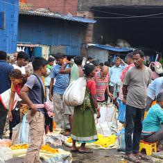
On the day the Indian Meteorological Department declared that the monsoon had officially set in over Kerala, the state’s capital had only one brief shower – before the official announcement came.
Thiruvananthapuram has seen intermittent heavy pre-monsoon showers since the middle of May. It even had a week of torrential rain in the middle of May. But on Friday at noon, when the Met Department announced the monsoon’s arrival, the temperature in the city was still 29 degrees, with few strong winds. Only the distinctive fragrance of freshly wet mud gave any indication that it had rained that morning.
This, said K Santhosh, director at the Meteorological Centre in Thiruvananthapuram, is entirely normal. “Trivandrum always gets less rain than places like Cochin and Kozhikode,” he said. “Besides, we don’t declare the rains based only on whether or not Trivandrum gets any.”
There are three parameters for the monsoon to be declared, he said. Sixty percent of the department’s 14 stations along the west coast must receive rainfall for two days in a row. The clouds racing across the Arabian Sea must achieve a certain height. And satellite imagery must show a far lower degree of heat radiating from the ground over a significantly large area.
Given that one tends to think of the southwest monsoon as a singular overwhelming force that rushes from sea to land, lashing everything in its way, this might seem like something of an anticlimax.
Unfortunately, "mostly dry" might prove to be the forecast for much of the monsoon to come.
After a normal monsoon last year that yielded above average rainfall, the Met Department has predicted that the country as a whole will receive 95% of its usual rain. This is an average spread across the country, so certain areas might be more affected than others. Drought-like conditions followed by severe torrential rains in 2012 had destroyed crops in several parts of India, and to heavy water and power cuts before the monsoon had even ended.
This summer has been particularly vicious. If the monsoon fails, the newly elected prime minister’s plans for economic revival might be set back even further.
This year sees a repeat of the El Niño phenomenon, a condition of warm water in the Pacific Ocean that scientists link, among other things, to a poor southwest monsoon in South Asia. But even if El Niño did not exist, the outlook for the next few months could be bleak.
“There are a combination of push factors and pull factors that bring the monsoon across India,” said Santhosh. “Right now, there are only push ones, which is a concern.”
Usually, a low-pressure trough forming over the Bay of Bengal pulls the monsoon winds from across the Arabian Sea to travel across the Indian subcontinent. This trough has been slow in forming this year.
There might even be a possible cyclone near the Gulf that could divert monsoon winds heading to India and lead to some more days of scanty rainfall across the western coast.
At the Meteorological Centre in Thiruvananthapuram, Santhosh spent most of Friday fielding inquiries from the press. His answers were always the same: the monsoon will cover Kochi in two days, it will move up the coast until Karwar, and after that, we don’t know what will happen.
The monsoon will reach Mumbai and Gujarat in ten days, he thinks – give or take four or five days, which is about as much accuracy as experts can achieve for a phenomenon as complex as the southwest monsoon.
“The monsoon is like a huge drama,” said Santhosh. “Just one person acting badly can make the entire thing flop. But if all the actors (and factors) perform well, the play becomes something grand and beautiful.”
Read Mridula Chari's previous dispatches here.