

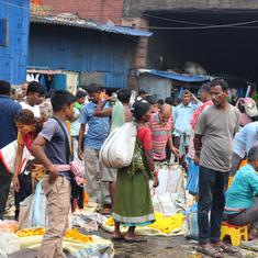


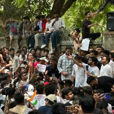

The intense rains and floods in Tamil Nadu have already claimed more than 260 lives over the past month and Chennai, the capital city, has been paralysed for the last three days. In the course of Tuesday and Wednesday, the city recorded twice the amount of rainfall it had expected all month. But for environment activists who have been ringing warning bells for years, the devastating floods are not a natural disaster: they are the obvious result of unrestrained construction along Chennai’s river banks and flood plains. If these wetlands had been left alone, several parts of the city would probably have been saved from submersion.
But this story, as ecologists across the country point out, is neither new nor unique to Chennai. Indian cities routinely undermine their own security by flouting basic norms of urban planning, and then refuse to learn lessons when spells of heavy rain lead to calamity.
Analyses of the Mumbai floods of July 2005, the Surat floods of August 2006, the September 2014 floods in Srinagar and Kashmir and several other cases of urban flooding in the past ten years point to the same, recurring causes.
“In all these cases, there has been rampant construction on flood plains,” said Dayanand Stalin, an environmentalist from the non-profit Vanashakti in Mumbai. “Urban planning guidelines and Coastal Regulation Zone rules clearly state that flood plains, wetlands and forests must not be made available for construction, but no municipal corporation actually follows these rules.”
Mumbai, July 2005
On July 26, 2005, Maharashtra’s western coast was hit by a record 944 mm of concentrated rainfall that brought Mumbai and the surrounding metropolitan region to a standstill for at least three days. Parts of the city’s suburbs were submerged in as much as 10 feet of water and more than 1,000 people lost their lives across the coast.
Mumbai’s low-lying areas were the worst affected, particularly after the Mithi river, which snakes through the centre of the city, overflowed its banks. “Environmentalists had been raising an alarm about heavy silting in the Mithi river for a long time, but these voices are always ignored,” said Rishi Aggarwal, an environment activist and a fellow at the Observer Research Foundation think tank.
“The same thing has happened with the Buckingham Canal in Chennai today,” said Aggarwal. The Buckingham Canal was an inland waterway running through Chennai that now has a Mass Rapid Transit System constructed over it.
Despite the nightmare of July 2005, Mumbai has clearly not learnt a lesson. “The estuary of the Mithi river has been taken over by constructions – the office of the MMRDA [Mumbai Metropolitan Region Development Authority] is itself built on the river bank,” said Stalin.
In the past ten years, adds Aggarwal, low-lying areas like Parel have seen a major construction boom, with some of Mumbai’s tallest commercial buildings built there. Soil that was once porous enough to absorb rainwater has been now concretised deep below the surface with the foundations of these buildings.
“The size of the storm water drains in these areas, however, have not been increased proportionately, so the small drains are now carrying bigger burdens,” said Stalin.
Surat, August 2006
From August 5 to August 9, 2006, more than two million people in and around Surat were trapped in torrential flooding after heavy rains and the Gujarat government’s decision to release large amounts of water from the Ukai dam.
In reports by the People’s Committee on Gujarat Floods and the Surat Citizen’s Council Trust Committee, the state government came under fire for mismanaging the release of the dam water and for failing to see the signs of an impending flood. But the reports, prepared by teams of experts including architects, engineers and social scientists, also pointed to the faulty urban development practices that aggravated the water-logging in the city.
The banks of the Tapi, for instance, had seen rampant encroachment by industries and apartment buildings, reducing the river's capacity to carry additional water during heavy rains. Rivers serve as drainage networks in urban situations, but with growing construction on their flood plains, Surat has seen increasing instances of monsoon inundation in the past few years, the report says.
Srinagar, September 2014
While the September floods of 2014 left a trail of destruction across Kashmir – in both India and Pakistan – ecologists couldn’t help noting that the consistent encroachment of water bodies in Srinagar and surrounding parts of the valley was the reason behind a lot of the flooding.
According to a study by the Directorate of Environment, Ecology and Remote Sensing in Srinagar, more than half the water bodies in and around the state’s capital have been lost in the past century, and the process of urbanisation is only speeding up.
The marshy peripheries of the Dal lake have been reclaimed for construction; encroachments along the Wular lake have reduced its spread from 20,200 hectares to a mere 2,400 hectares. Rapid urbanisation also leads to more soil erosion and silting of lakes and rivers – one of the reasons why the Jhelum overflowed and inundated Srinagar last September.
“What is happening in Chennai is no different,” said Stalin, pointing out that 171 lakes and water bodies in the city have been subjected to varying degrees of reclamation over the years. “Chennai had 5,200 hectares of fresh water swamps some ten years ago. Today, barely 500 hectares are left.”
We welcome your comments at
letters@scroll.in.
But this story, as ecologists across the country point out, is neither new nor unique to Chennai. Indian cities routinely undermine their own security by flouting basic norms of urban planning, and then refuse to learn lessons when spells of heavy rain lead to calamity.
Analyses of the Mumbai floods of July 2005, the Surat floods of August 2006, the September 2014 floods in Srinagar and Kashmir and several other cases of urban flooding in the past ten years point to the same, recurring causes.
“In all these cases, there has been rampant construction on flood plains,” said Dayanand Stalin, an environmentalist from the non-profit Vanashakti in Mumbai. “Urban planning guidelines and Coastal Regulation Zone rules clearly state that flood plains, wetlands and forests must not be made available for construction, but no municipal corporation actually follows these rules.”
Mumbai, July 2005
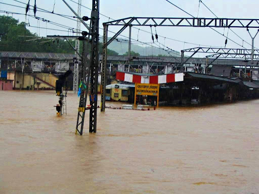
On July 26, 2005, Maharashtra’s western coast was hit by a record 944 mm of concentrated rainfall that brought Mumbai and the surrounding metropolitan region to a standstill for at least three days. Parts of the city’s suburbs were submerged in as much as 10 feet of water and more than 1,000 people lost their lives across the coast.

Flooding in Mumbai on 26/7, 2005. Photo: Sebastian D'Souza/AFP
Mumbai’s low-lying areas were the worst affected, particularly after the Mithi river, which snakes through the centre of the city, overflowed its banks. “Environmentalists had been raising an alarm about heavy silting in the Mithi river for a long time, but these voices are always ignored,” said Rishi Aggarwal, an environment activist and a fellow at the Observer Research Foundation think tank.
“The same thing has happened with the Buckingham Canal in Chennai today,” said Aggarwal. The Buckingham Canal was an inland waterway running through Chennai that now has a Mass Rapid Transit System constructed over it.
Despite the nightmare of July 2005, Mumbai has clearly not learnt a lesson. “The estuary of the Mithi river has been taken over by constructions – the office of the MMRDA [Mumbai Metropolitan Region Development Authority] is itself built on the river bank,” said Stalin.
A suburban railway station flooded in Mumbai, July 2005. Photo: Wikimedia Commons
In the past ten years, adds Aggarwal, low-lying areas like Parel have seen a major construction boom, with some of Mumbai’s tallest commercial buildings built there. Soil that was once porous enough to absorb rainwater has been now concretised deep below the surface with the foundations of these buildings.
“The size of the storm water drains in these areas, however, have not been increased proportionately, so the small drains are now carrying bigger burdens,” said Stalin.
Surat, August 2006
From August 5 to August 9, 2006, more than two million people in and around Surat were trapped in torrential flooding after heavy rains and the Gujarat government’s decision to release large amounts of water from the Ukai dam.
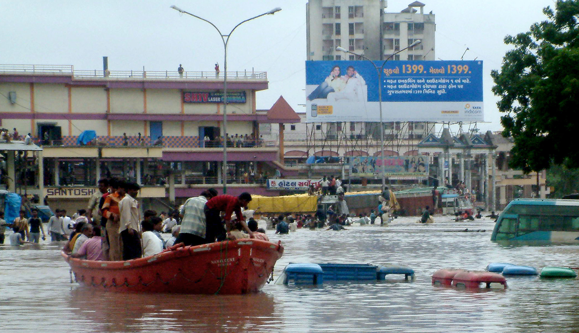
A boat attempts to rescue residents in Surat during the floods of August 2006. Photo: STRDEL/AFP
In reports by the People’s Committee on Gujarat Floods and the Surat Citizen’s Council Trust Committee, the state government came under fire for mismanaging the release of the dam water and for failing to see the signs of an impending flood. But the reports, prepared by teams of experts including architects, engineers and social scientists, also pointed to the faulty urban development practices that aggravated the water-logging in the city.
The banks of the Tapi, for instance, had seen rampant encroachment by industries and apartment buildings, reducing the river's capacity to carry additional water during heavy rains. Rivers serve as drainage networks in urban situations, but with growing construction on their flood plains, Surat has seen increasing instances of monsoon inundation in the past few years, the report says.

A building that collapsed in Surat in August 2006. Photo: Reuters, Amit Dave
Srinagar, September 2014
While the September floods of 2014 left a trail of destruction across Kashmir – in both India and Pakistan – ecologists couldn’t help noting that the consistent encroachment of water bodies in Srinagar and surrounding parts of the valley was the reason behind a lot of the flooding.
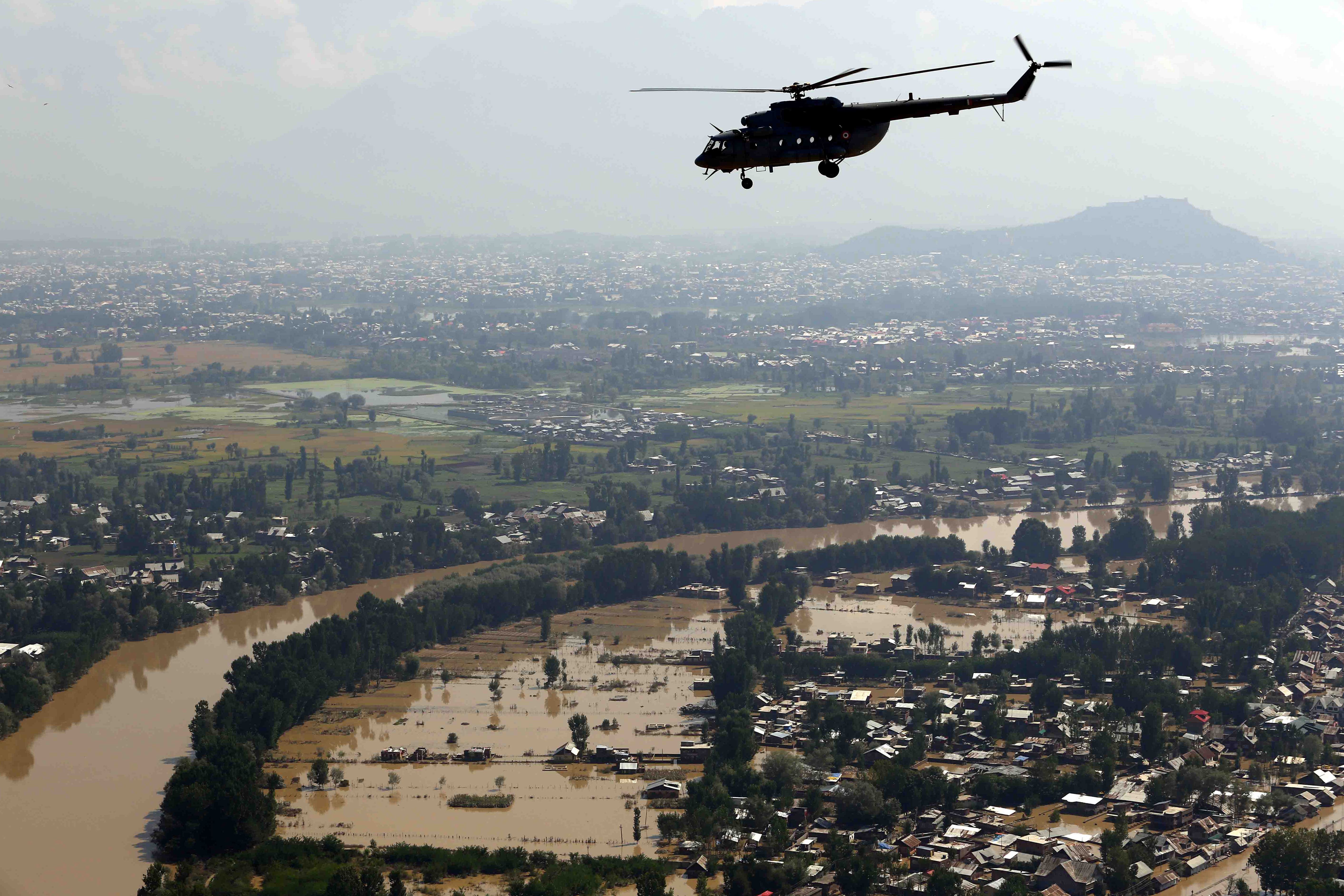
Rescue operations underway in Srinagar, September 2014. Photo: Vijay Kumar / Ministry of Defence / AFP
According to a study by the Directorate of Environment, Ecology and Remote Sensing in Srinagar, more than half the water bodies in and around the state’s capital have been lost in the past century, and the process of urbanisation is only speeding up.
The marshy peripheries of the Dal lake have been reclaimed for construction; encroachments along the Wular lake have reduced its spread from 20,200 hectares to a mere 2,400 hectares. Rapid urbanisation also leads to more soil erosion and silting of lakes and rivers – one of the reasons why the Jhelum overflowed and inundated Srinagar last September.

An army raft in Srinagar, September 2014. Photo: Punit Paranjpe / AFP
“What is happening in Chennai is no different,” said Stalin, pointing out that 171 lakes and water bodies in the city have been subjected to varying degrees of reclamation over the years. “Chennai had 5,200 hectares of fresh water swamps some ten years ago. Today, barely 500 hectares are left.”