


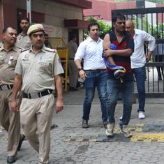

Long considered one of the global leaders in disaster management, Bangladesh has had a traumatic experience with this year’s floods – with many of these deaths coming in areas that are not considered “flood prone”. The department of disaster management said that as of August 17, 61 people, including many children, died in the floods that affected 26 districts.
At least 42 people drowned in northern districts of Dinajpur and Kurigram alone as vast swath of the two highland regions was inundated by the Brahmaputra, the Teesta, the Punarbhaba, Atrai, Tangon and other rivers entering Bangladesh from India. The weeks of torrential rain inside Bangladesh aggravated the ongoing flood that started invading from the northern tip since August 12.
“In less than two days, water crossed through the windows of our house. We are not used to floods [here],” said 55-year-old Mozammel Hossain, a resident of Dinajpur, most of which has been under at least five feet of water for days. “I waded through the flood water dragging my motorcycle under water. As Dinajpur is not flood prone, we could not find even 10 boats for shifting people, especially women, children and elderly person, to safer places,” he said.
Mohammed Golam Rabbi, an additional deputy commissioner of Dinajpur district, told thethirdpole.net that the ongoing flood claimed 28 lives, the highest from any region, including babies and elderly. In another northern district, Kurigram, 14 people, including some children, died. “Most of them [in Dinajpur] drowned. At least three people died as earthen wall of houses collapsed and one person died of snake bite,” said Rabbi.
Kurigram deputy commissioner ASM Ferdous Khan told thethirdpole.net that many of the people who died in the recent floods could not swim. He said if the people could swim, many of the lives could be saved.
Iqbalur Rahman, the MP elected from Dinajpur town constituency, told thethirdpole.net, “We do not have big river. Dinajpur is a highland district and most of the people are not used to flooding. Majority of the people here do not know swimming. Therefore, they failed to cope with the sudden onrush of water from the upstream”.
Rahman added, “I collected some boats from other districts to shift people to the safer places and shelter homes.”
Punarbhaba, Tangon and Atrai crisscross the greater Dinajpur district are considered the country’s food basket.

A continuing disaster
According to the department of disaster management, 4.8 million people in 26 districts would see inundation as waters recede from the northern part.
Saiful Hossain, a superintendent engineer at the flood forecasting and wrangling centre functioning under the water resources ministry, told thethirdpole.net that the flood situation in the northern region was likely to improve, while the situation will worsen at the central and southern and southwestern parts. “The flood will continue at least four days,” he said.
History forgotten
Water expert Ainun Nishat said that the deaths in Dinajpur and other northern districts could be prevented if forecast of severe incoming flood was communicated to the people as had been done in previous years.
“Look, Dinajpur is not flood prone; flood took place there after 30 years (in 1987-’88),” he said. “People in the district have forgotten the memory of flooding; their capacity to cope with floods lost. Also, depth of the major river in the greater Dinajpur such as the Punarbhaba, the Tangon and the Atrai has come down; the water holding capacity of the rivers got reduced.”
The 1988 flooding was the severest in Bangladesh history. The two spells of floods affected around 45 million people across the country including the northern region, according to the disaster management department. At least 1,621 people died in the 1988 floods.
The death toll in the 1987 floods was 1,470. The disaster management department said 347 sub-districts in 50 districts including the northern region were affected in 1987.
Nishat said the flood protection embankments in Dinajpur were not maintained over the years as flooding did not recur. “The rivers (in the greater Dinajpur) carry bulk waters from upstream in India that experienced huge rain this year,” he said. “Local heavy rain puts extra pressure on the rivers. So, the embankment collapsed due to huge pressure of waters.”
He said the latest flooding in the northern region was a lesson for Bangladesh.
“All flood protection embankments must be maintained every year no matter whether flooding took place or not. If the embankments were maintained properly, people could get enough time to move to safer places. Such loss of life could be prevented,” said Ainun Nishat.
He said Bangladesh got data on this year’s flood from India, China and other countries.
Shawkat Ali, an engineer who used to be in charge of hydrology and flood forecasting wings of the water development board, told thethirdpole.net that unlike the northwestern parts, the people in the southern and central districts are used to floods, river erosion, cyclone and other natural calamities and there are very few deaths despite severe floods.
Transboundary cooperation
After the 1987 flood, the government under criticism took comprehensive plan to develop flood forecasting and warning system with the help of the international community. Upgradation of the warning system was aimed at warning people so that the damages could be reduced

“Sharing of the data on transboundary rivers helps us better prepare for floods and reduce damages and loss of lives,” Saiful Hossain, an engineer at the flood forecasting and warning system of the water development board, said.
In order to improve the flood forecasting and warning system, Bangladesh reached out to India, China, Nepal and Bhutan – the countries sharing the Brahmaputra, the Ganga, Meghan river basins.
Urbanisation forces the poor into floodplains
Shantu Miah, 65, a farmer in Birol, Dinajpur, said the death toll and damages in floods would have been reduced if the government could stop construction of houses on the floodplains.
The rural poor have been continuing the practice of building houses in the low-lying areas in the countryside. This is because the price of the land in the floodplains is lower. Many people sell their homesteads in highlands to rich clients hungry for land as the pace of urbanisation increases.
The people then shift their houses to the low lying floodplains, and become the victim of inundation. This practice has been pervasive across the country. For instance, the Dhaka-Narayanganj-Demra project in the outskirts in Dhaka was originally developed on a low-lying land for agricultural purposes. But the people made it a residential purpose. The area now faces severe waterlogging and flooding frequently.
“If we build houses on the low land and ditches, flood is sure to damage the house and kill people,” he said.
This article first appeared on The ThirdPole.