


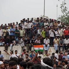


In the latest instalment of a long-drawn border war, India and Pakistan are thundering at each other through weather bulletins. Last week the Indian Meteorological Department subtly renamed the Jammu and Kashmir subdivision as the Jammu and Kashmir, Ladakh, Gilgit-Baltistan and Muzaffarabad subdivision. Temperatures for all regions were broadcast on All India Radio and Doordarshan.
While Muzaffarabad is a town in Pakistan-occupied-Kashmir, Gilgit-Baltistan is the left tip of the crown-shaped territory of Jammu and Kashmir.
Not to be outdone, Radio Pakistan started reading out weather updates for “Indian-occupied-Jammu and Kashmir”. In most parts of the region, “partly cloudy weather is expected with chances of rain,” said the forecast, in what seemed to be darkly metaphorical language.
For Ladakh, it bent the laws of nature. The maximum temperature recorded in the mountainous desert region was -4 degrees Centigrade and the minimum -1 degrees Centigrade, the radio channel initially reported.
When it comes to Jammu and Kashmir, the sky’s the limit, to borrow former Prime Minister PV Narasimha Rao’s words. Both India and Pakistan, however, are more interested in what lies beneath the skies.
Skies over Gilgit-Baltistan
For now, the centre of attention is Gilgit-Baltistan, a high-altitude region about five times the size of Pakistan-occupied-Kashmir but sparsely populated. India’s renewed interest in the region comes after the Pakistan Supreme Court gave the go-ahead to amend the Gilgit-Baltistan Order of 2018 and hold general elections there.
Delhi issued demarches: Gilgit-Baltistan was an “integral part of India by virtue of its fully legal and irrevocable accession”, so Pakistan, its courts and governments, had no power to make decisions about it. Delhi’s claims had no “legal basis whatsoever,” the Pakistan Foreign Office retorted.
The region is remote from both Delhi and Islamabad. Its ties to Jammu and Kashmir are also tenuous. When the British sold Jammu and Kashmir to the Dogra king in 1846, Gilgit-Baltistan was parcelled off as well. Later, the colonial government leased it from the Dogra king. For years, the region was cut off from the political churn in the princely state.
Before partition in 1947, the lease was cancelled and the area handed back to a Dogra governor. Delhi has never had administrative control over the region, but it considers Gilgit-Baltistan part of the Dogra state that acceded to the Indian Union in 1947.

As the border war of 1947 broke out, the Gilgit Scouts rose up in rebellion under the leadership of Major William Brown, a British military officer, and the region passed into Pakistani control. In 1963, Pakistan ceded control of the Shaksgam Valley in Gilgit-Baltistan to China, whose interests in the region have grown over the decades. A section of the China Pakistan Economic Corridor is slated to pass through the region.
According to Pakistan, Gilgit-Baltistan was an “autonomous area” rather than a province. But that claim has worn thin. Till 2009, Gilgit-Baltistan was called the Northern Areas. Then Islamabad passed the Gilgit-Baltistan (Empowerment and Self-Governance) Order, which gave it the illusion of autonomy. With the 2018 order this was reversed. Islamabad unilaterally seized the powers of the local council and vested the prime minister of Pakistan with indisputable authority over the region. The fiction of autonomy seemed to have been dispensed with.
The foreign ministry said the action could not hide Pakistan’s “illegal occupation” of a region that was an “integral part” of India. After August 5, 2019, when Delhi stripped Jammu and Kashmir of special status under Article 370 and downgraded the state into two Union Territories, Pakistan responded in kind – these were “illegal steps” taken in “disputed territory”.
A map released by the government last year showed Gilgit-Baltistan as part of the newly created Union Territory of Ladakh.
Imagined communities
Reading the weather is really a counterpart to these cartographic projects. Even Google maps have helped each country preserve political claims. Run a search in India and the familiar crown-shaped territory, complete with Gilgit-Baltistan, Pakistan-occupied-Kashmir and the parts of Ladakh beyond the Line of Actual Control, are firmly within national borders.
Elsewhere in the world, says in this article in the Washington Post, the solid border around Jammu and Kashmir fades into a dotted line to indicate this is contentious territory. The Line of Control and the Line of Actual Control appear on the map.
Maybe the Indian government reasons that knowing how hot or cold it is on the other side of the Line of Control, how windy, how rainy, will draw these towns and mountains into the imagined community of a nation. But how well does it know the actual community living in Gilgit-Baltistan, a Shia-majority region with several languages and ethnicities, with its own political and economic aspirations, its own history? Maps and the weather do not tell you these things.