


The term “natural” can hardly be used to refer to disasters anymore. “When threats strike a community and wreak havoc, it is assumed people did something wrong, such as deforestation, [or] building in a river channel or on a very steep slope,” explains meteorologist Marcelo Seluchi.
Seluchi runs the operation and modeling sector of the Center for Monitoring and Early Warning of Natural Disasters (Cemaden), a federal agency based in São Paulo, Brazil. The centre is in charge of observing vulnerable areas in about one-fifth of the country’s 5,568 municipalities, where landslides and floods have the most impact. Nine out of every 100 Brazilians live in these high-risk zones.
Over the past decades, urbanisation in Brazil has been largely unplanned and has taken place at a chaotic pace. According to the Brazilian Institute of Geography and Statistics, 84% of people live in cities and urban areas.
“Nobody is going to live in a risky area because they want to or because they are stupid,” says Raquel Rolnik, an urbanist from the University of São Paulo. “They are workers whose income does not allow for the purchase or rent of housing in a suitable location.”
Larger populations living in high-exposure areas and more frequent extreme weather events trigger disasters. Science has proven that global warming has boosted evaporation, adding more water vapor to the air, which causes more intense precipitation and unpredictable storms. This makes landslides even more common in Brazil’s Atlantic Forest, including the Serra do Mar mountains, which extend for 930 miles along the country’s coastline and reach up to 7,700 feet in elevation.
The rocks that comprise these mountains are covered by a thin layer of soil and vegetation, with a natural tendency to slide, explains Fábio Augusto Reis Gomes, a geologist at São Paulo State University. “Heavy rains make water infiltrate this soil, turning it into liquid.” This liquid debris flows quickly downhill on these steep slopes, some greater than 25 degrees.
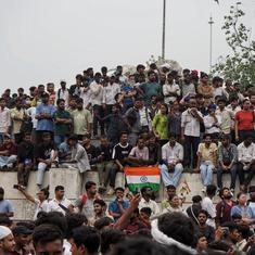
That’s just what happened on Thursday, February 16, 2023, when record-setting rains hit the São Paulo coast in southeast Brazil. That day, Cemaden predicted heavy rainfall and reported the dangers twice to local authorities. On Saturday night, municipalities received more specific alerts to put their contingency plans in place, having reached the maximum level of risk by midnight, according to Cemaden.
However, various local municipalities responded differently to the information, and the resulting range of outcomes shows what’s at stake for communities in future disasters.

Effective warning systems
While Cemaden’s forecasts predicted 7.8 inches of rain, the cities of Bertioga and São Sebastião received more than three times that amount. In Bertioga, 26.8 inches of rain fell in just one day – the highest amount ever recorded by a rain gauge in Brazil (not counting unmonitored areas).
Since the city of Bertioga, population 65,000, is relatively flat and doesn’t have residences built in the hills, it was not particularly vulnerable. “The biggest rain in history occurred there, but with no problems in terms of causing victims,” Seluchi says.
The story was different 20 miles east, in the city of São Sebastião, population 90,000. Here, in the early hours of Sunday morning, rain gauges recorded 24.6 inches of rain. Storms followed by landslides swept through a working-class complex on the slopes of Serra do Mar called Vila do Sahy, killing 64 people.
These homes were built in the 1980s by poor families looking for jobs in the nearby beachside hot spot of Barra do Sahy, where wealthy families from big cities come for the sea-view hotels and well-equipped houses costing millions of dollars.

Despite their differences, Barra and Vila are closely linked. The only physical barrier between them is a single road. However, precarious housing conditions in the high-risk area concentrated all the victims on the road’s poorest side, while on the opposite side, some wealthy people hired helicopters to escape the devastation.
The city of São Sebastião did not release a single statement informing the public about the storms, which came in the days leading up to Carnival – one of Brazil’s most important holidays for tourism. Preparations for the festivities were already in full swing. Normally, the city receives 500,000 visitors on Carnival weekend, so ordering an evacuation would mean losing the income potential of these tourists. Instead, lives were lost.
Twenty miles west of Bertioga, the city of Guarujá, population 322,000, had only infrastructure damage and no injuries in the storms despite having more than 7,000 families living on slopes and in stilt houses. The city recorded the highest volume of rain in the past 70 years: around 16 inches. The municipality managed to avoid fatalities by listening to the warnings and not underestimating the conditions’ destructive potential – a lesson learned after experiencing landslides and floods in 2020 that left 34 dead.
When the 2023 storm hit, people from high-risk areas left their homes before getting impacted by the rain. The Civil Defense notified the population via social media, SMS, and on-site visits. (This is comparable to the United States Federal Emergency Management Agency, FEMA, but in Brazil, municipalities and states also have their own Civil Defense offices.)
“Teams went to areas of geological risk on Friday and Saturday informing [them of ] the measures to be adopted in case of heavy rain, and community leaders reinforced the alert,” according to an email from the City Hall of Guarujá’s press office.
However, an effective disaster prevention plan has to go beyond warnings.
Convincing people to act
Across Brazil, only 17% of municipalities have alert systems to inform residents about possible risky situations associated with heavy rains. According to Reis, who is also a director of the Brazilian Federation of Geologists, some communities only have sirens, which isn’t enough. “Sound alerts are the last step in the line because when [a major storm] hits, many people don’t know what to do,” he says. “Before that, it is necessary to do training and simulations, mapping escape routes and shelter points.”
Without an escape plan, evacuation warnings don’t do much good. That’s why Guarujá Civil Defense’s ongoing work includes daily inspections in high-risk areas, climate monitoring, a geotechnical data platform, and lectures given in schools alongside simulations. “Cities are dynamic, and risk areas change over the years, so the mapping must be updated and the population informed about these changes during the training,” Reis says.
The Brazilian Federation of Geologists highlights the problematic ways in which high-risk areas are often a low priority for administrations. “Disasters do not occur due to lack of technical knowledge, but mostly by negligence of local, state, and federal administrations. [The] risk management field has well-known mechanisms and tools; whenever applied in time, they result in success,” reads a statement released on February 24 to authorities and civil society.
Many deaths could be avoided if, for example, safe long-term housing was available and affordable for everyone.
One of the most important aspects of any safety plan is to convince the population of the danger. Even when people have the necessary information, some still refuse to leave their homes, fearing their belongings being looted, or they simply distrust the warning. “Some residents say, ‘I’ve lived here for 40, 50 years, and [no] disaster has ever happened,’” Seluchi says. “This is a big mistake because today, things that have never happened are happening now – rain with a frequency of every 50 years now occurs every five to 10 years.”
Solutions at the source
In the face of an evermore-threatening climate future, some communities have found their means of raising awareness and preventing fatalities. Sítio Conceiçãozinha is a century-old neighborhood on the Guarujá estuary where some of the community’s 6,000 residents live in homes built on stilts. Flooding was a problem for decades until the local community center launched an environmental project in 2020.
Primarily aimed at cleaning up street pollution, the project found that reducing garbage backing up storm drains could also avoid floods. The project offers educational programs for families as well as janitorial services. The cleanup works as a credit market: For each kilogram of recyclable material, such as plastic bottles, a person earns tickets that can then be exchanged for donated food baskets. Every month, the community collects more than a ton of recycled material.
“Recently, heavy rains have filled Guarujá up, but not here,” says Cristiane Santos de Lima, one of the women heading the project. “The streets don’t flood anymore because you can’t find bottles covering the drains, obstructing the water evasion.”
This story was originally published in Yes! Magazine (US) and is republished within the Human Journalism Network program, supported by the ICFJ, International Center for Journalists.