


History is said to be the original discipline in the faculties today known as humanities. This is owing to the fact that every discipline in knowledge discourse has a history – even abstract disciplines like mathematics or astronomy – and every piece of history has a geophysical contextuality.
Ever since Herodotus (484 BC - 425 BC, Greek-occupied Turkey) started the discipline, he recorded events during the reign of four Persian kings and chronicled life and society in their times. These were times of conflict between Greece and Persia and had a geographical contextuality.
Herodotus also speaks of “India”, where he saw the Himalayan marmot bathing in gold dust. Much later, deconstructing his text led to the conclusion that the great father of historical praxis must have passed through the North West Frontier province and reached the base of Hindu Kush.
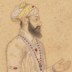
This posed a question, which Herodotus did not ask himself: if he had indeed travelled to “India”, which “India” was this? For that matter, if he was “Greek”, which “Greece” did he live in? Similarly. if Ram of the epic poem Ramayana was an “Indian”, where was this “India” situated?
The so-called Ram Setu
A ship that wishes to sail from the Arabian Sea to the Bay of Bengal has to pass through the Indian Ocean to the south of Sri Lanka. The voyage would have been 30 hours shorter if it could have travelled along the Gulf Of Mannar, which separates India and Sri Lanka, but this isn’t possible. For there are thousands of small submerged rocks beneath its surface, stretching like a bridge across 47 km between the two countries. As a result, the sea is between one and 30 metre deep here, which isn’t favourable for sailing.
The British government of colonised India as well the government of independent India had often planned to dredge the channel to make it suitable for sailing; but the plans have remained elusive for various reasons. At present, for instance, Hindutva followers believe that this is the bridge built by an army of monkeys, as described in the Ramayana, which Ram and Lakshaman crossed to conquer Sri Lanka.
Their demand is that, far from dredging, let the Archaeological Survey of India declare this bridge a national monument. Not that the colonisers were any less fundamentalist. In 1804 a certain British cartographer named the structure Adam’s Bridge – according to him this was the bridge described in the Bible which Adam crossed to scale a mountain peak, where he meditated for 1,000 years while standing on one leg.
Even before this, we have seen Marco Polo describe the structure as a bridge, as did Al-Biruni in the book he wrote in 1030 CE. In other words, it has long been held that this row of rocks beneath the surface of the water is a bridge.
Not exactly a bridge
According to geologists this structure is actually a limestone shoal, the outcome of natural processes. Between 300 and 30 million years ago, a portion of the Indian subcontinent is believed to have broken off because of continental drift to form the island of Sri Lanka. The debris that this fragment of land left behind at birth in the water as it drifted away led to the creation of this so-called bridge.
It may have jutted out of the water at some point in history, in which case it might have been used as a bridge. But there is considerable doubt whether the users belonged to the age of the Ramayana. This is because the inhabitants of Sri Lanka went directly from the Stone Age to the Iron Age; the use of copper was not very prevalent here. On the other hand, the Ramayana is a tale from an advanced Copper Age – an epic in verse from a period two or three thousand years before the Iron Age.
Where was Ramayana set?
Let us drop the preamble and get to the point now. If the Lanka mentioned in the Ramayana was not the Sri Lanka of today, where was it located? Where did Ram belong, for that matter? Wherever he may have lived, he was certainly not an inhabitant of what is the Ganges valley today, or of “Ramjanmabhoomi” Ayodhya. For, civilised man did not live in the forest-infested Ganges valley before the Iron Age, since there were no axes with which to clear the vegetation before iron was discovered. There were no swords either, which proves that the Ramayana, unlike the Mahabaharata, is not an epic of the Ganges valley. It makes no mention of swords – the bow and arrow are the primary weapons in it.
The primary objective of this essay is to point to the geographical location of the Ramayana. It is not the writer who has arrived at the answer, nor an Indologist like Max Mueller or even a historian or archaeologist. The person in question is Rajesh Kochhar, a physicist with an inclination for history, who has broken through the traditional techniques of history in his work The Vedic People – Their History and Geography.
How the Ramayana is different from the Mahabharata
The primary difficulty of discussing the ancient history of India lies in the necessity of first demolishing several well-established inaccuracies, such as the Aryan Invasion Theory, for instance. Spun by white men and broadcast by colonial historians, this old wives’ tale is still taught in schools and colleges, with half of any written work – measured in terms of paper, ink and effort - being expended on it. We shall not entertain it. We will only examine whatever can be determined through the social and geographical pointers available in the Ramayana.
There are two other fundamental differences between the Ramayana and the Mahabharata – in the rivers and in the divine pantheon. In the Mahabharata the Ganga and the Yamuna are almost ubiquitous, but they’re completely missing from the Ramayana. In the Mahabharata we see the powerful presence of the Hindu trinity of Brahma, Vishnu and Maheshwar – but they’re absent from the Ramayana. We do not find these two rivers and these three gods together in the Rig Veda.
However, the rivers and gods that are to be found in the Rig Veda are also to be found in the Ramayana – the rivers Saraswati and Sarayu, and the original trinity of Agni, Varun and Pavan. From this it is easy to surmise that the Ramayana is a Rig Vedic epic. Which period was this? It would not be correct to estimate this using our current calendar: it would probably not be possible either. An approximation can be made from the sequence of events.
The somras clue
Vedic nomads travelled from the Eastern Europe to Bactria (present day Afghanistan). From here they went to Persia (today’s Iran). During their migration to Persia there was probably a battle for power amongst the gods, which led to the birth of the Avestan religion. As a result, Indra, the king of gods, became an inferior figure in the Avesta, while Yama, the god of death, turned into the finest of the gods. Worshipping Agni is a prominent practice within the Parsi community, but Hindus do not worship this ancient god. This indicates that the Rig Vedic age predated Persia. Kochhar has provided clues to whether this was the Afghan branch of the Vedic journey.
The first such clue that Kochhar alludes to is the Vedic drink somras. It was so important in ancient Vedic life that an entire mandala or chapter of the Rig Veda has been devoted to it. The importance of soma is evident in the Avestan Zend scripture – it is referred to as haoma in Persia. It is seen that the closer the Vedic nomads get to the Indian peninsula, the more they seek continuously new alternatives to the soma plant; that was how important somras was.
But the original soma plant was to be found only in what is modern day Afghanistan and Persia or Iran. In 1951 the German historian Karl Friedrich Geldner proved that the ephedra plant was what was described as soma in the Rig Veda. Ephedrin or somras is not alcohol – this intoxicant is an alkaloid. Kochhar’s investigations led to the discovery of four varieties of ephedra, found in Afghanistan, Iran, the northern Himalayas, and the Hindu Kush.
What we learn from summer solstice
There are 49 cosmic hymns in the Rig and the Yajur Vedas whose meanings have not been explained. But one particular hymn from Vedanga Jyotish informs us that the longest day of the year, or summer solstice, comprised 18 periods of daylight and 12 of night. Day and night are of equal length on the Equator; in the higher latitudes, summer days are longer than nights.
The latitude at which the proportion of daylight and darkness is 3:2 is 34 degrees North. It is worth noting that the cities to be found around this latitude today are Herat and Kabul in Afghanistan. In other words, the place and time of the composition of the Vedanga Jyotish is the same as that of Vedic Afghanistan and Iran. This second piece of evidence offered by Rajesh Kochhar further strengthens the perception of the location and time of the Rig Veda.
In search of the rivers
Kochhar has deconstructed the Rig Veda in search of the Saraswati and the Sarayu, the two rivers also mentioned in the Ramayana. Here too our current history has come in the way.
There is a tiny river named the Sarayu in Uttar Pradesh, which flows into the Ghaghara, which in turn merges with the Ganga. Many people consider the rainwater-fed Saraswati in the Aravallis, flowing along the Ghaggar (not to be confused with the Ghaghara) basin the mythical Saraswati. On viewing the scans of North-Western India made by the Russian Landsat satellite between 1972 and ’79, it is natural to assume that the Ghaggar was a wide river. It flows into the Rann of Kutch.
The scan reveals the basin of a dried up older river, which is up to 8 km broad in some places. It was this that led to the hasty conclusion of this basin’s belonging to the original Saraswati.
From Neil Roberts’s The Holocene it is clear that the basin of this river widened to the north of the Rann of Kutch because of the accelerated movement of a glacier during the previous Ice Age. But deconstructing the Rig Veda doesn’t suggest any of this. The Saraswati has been referred to as non-perennial towards the end of the Veda. The original stream of the Ghaggar enters India from present-day Pakistan, drying up in the Thar desert. Kochhar believes this is the non-perennial Saraswati.
However, the Saraswati of the Rig Veda is extremely powerful, grinding rocks with sheer force. Its roar subsumes all other sounds. And the Sarayu of the Rig Veda is immensely wide and deep, the mother river. None of these descriptions matches the actual rivers in present-day India with those names.
Hymn No. 5 | 53 | 9 of the Rig Veda says, “May the Rasa, Krumu, Anitabh, Kuva or Sindhu not be able to stop you; let the deep Sarayu not be an obstacle.” The order of the rivers clearly moves from east to west. So the Sarayu undoubtedly flows to the west of the Indus.
Kochhar believes it is the 650-km river known as the Hari-Rud in Afghanistan, whose source is in the Hindu Kush mountains. It flows past the city of Herat and then for 100 km along the Iran-Afghanistan border before disappearing in the Karakom desert of Central Asia.
In the Avesta we find the Saraswati as the Harahaiti – the similarity in sound is noticeable – which enters Iran along the combined basin of the river Arghandar on the Afghan-Iran border and the river Helmand. According to Kochhar, it is this Helmand that is the Vedic Saraswati river.
The source of the Helmand is in the Koh-i-Baba mountain range. Flowing for 1,300 miles through the heart of Afghanistan, the Vedic Saraswati joins the Vedic Drijadbati or Arghandar. The Avesta identifies this wide river as the Hetumanta (or, in varations, as Setumanta). In Iran the Saraswati is named the Harahaiti, which flows into the inland lake Hamun-e-Sabari in the Saistan area of northern Iran.
The conclusion
The political map of the ancient world, of the Copper Age, provides an extraordinary realisation. The kingdoms of the two main political powers – the Persians and the Greeks – all lie between and around the Red Sea and the Mediterranean Sea. None of these is a coastal civilisation, however.
This raises a question. What did ancient man refer to as a sea? The Mediterranean Sea, the Red Sea, and the Campian Sea are all saltwater lakes, and not seas in the way we understand them today. This make us wonder: perhaps the Lanka of the Ramayana was an island in the Hamun-e-Sabri.
The one thing that’s obvious: wherever it was that Ram and Lakshman went from Afghanistan, it could not have been to present-day Sri Lanka, for that would have meant crossing the Indian peninsula. And since Ravana, the lord of Lanka, was also partial to somras, it is unlikely that he went very far from the land of soma after abducting Sita.
Although it is not possible to prove archaeologically, there is considerable reason to assume that the lineage of Dasarath (and of Ram), the Ikshvakus, were from western Afghanistan. For the Puranas say that King Kubalasa slayed a demon on the shore of the Sabari. Vishwamitra received his second birth where the Saraswati met the sea. And Valmiki discovered Sita on the shore of the Sarayu. Which is why there is little room for doubt that today’s Hamun-e-Sabri is the sea mentioned in the Ramayana, one of the islands in which was the kingdom ruled by Ravana, lord of the rakshases.
The focus of attention for those studying the lost history of India is the contentious issue raised by Hindutva historians, who have repeatedly asserted that western historians have been unable to identify the roots of ancient India. We find these assertions in the writings of Bal Gangadhar Tilak, as well as in those of certain lesser known right-wing historians. It is surprising how easily conclusions unsupported by the array of Vedic texts can be arrived at because of mindless adherence to a popular brand of politics.
The rock formation between India and Sri Lanka could well be preserved, but not as Ram Setu or Adam’s Bridge. Let it be protected as a geological feature. For no matter how far one looks, no relationship is evident between this Lanka and the Lanka of the Ramayana.
Was the Ramayana actually set in and around today’s Afghanistan?
An examination of a book by physicist Rajesh Kochhar debunks the notion that the events of the epic took place in modern-day India.
